Elected Officials
Courts
Departments
Initiatives
Open Government
About
Login / Register
Home
/
Property & Tax Records
/
Property Records
/
Property & Tax Search
/
Parcel Profile
/
Print View
Search for Another Parcel
Parcel Profile
Historical Card
Sketches
Photos
Tax Map
Taxes
Print View
Print This Page
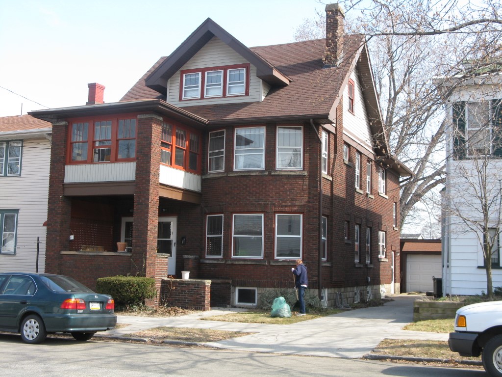
Address: 509 11 WALNUT ST
Parcel: 17040014011800
Parcel Profile
Address
509 | 11 | WALNUT | ST
Street Status
PAVED
School District
CITY OF ERIE SCHOOL
Acreage
0.0758
Classification
R
Land Use Code
TWO FAMILY
Legal Description
509 11 WALNUT ST 40X82.5
Square Feet
2406
Topo
LEVEL
Utility
ALL PUBLIC
Zoning
Please contact your municipal zoning officer
Deed Book
2016
Deed Page
018998
2026 Tax Values
Land Value / Taxable
7,600 / 7,600.00
Building Value / Taxable
81,600 / 81,600.00
Total Value / Taxable
89,200 / 89,200.00
Clean & Green
Inactive
Homestead Status
Inactive
Farmstead Status
Inactive
Lerta Amount
0
Lerta Expiration Year
0
Residential Data
Card 1
Style
OLD STYLE
Basement
FULL
Year Built
1923
Exterior Wall
BRICK
Total Living Area
2406
Full Baths
2
Half Baths
0
Fuel Type
GAS
Heating
CENTRAL
Heating System
HOT WATER
Stories
2.0
Total Bedrooms
4
Total Family Rooms
0
Total Rooms
10
Fireplaces
0
Other Buildings & Yards
No OBY Data Found
Sales History
Sale Date
Type
Price
Book / Page
Other Info
9/1/2016
LAND & BUILDING
428000
2016 / 018998
DEED
10/2/2014
LAND & BUILDING
0
2014 / 021124
QUIT CLAIM DEED
11/8/2013
LAND & BUILDING
0
2013 / 029389
QUIT CLAIM DEED
3/18/1968
0
0978 / 0120
Parcel Sketches
Residential Card 1
A
MAIN
1203 square feet
B
EFP ENCL FRAME PORCH EFP ENCL FRAME PORCH
56 square feet
C
OMP OPEN MASONRY PORCH EFP ENCL FRAME PORCH
144 square feet
Parcel Images
Please note:
this tab is for informational purposes only and may not show all delinquencies, see the Taxes tab for more accurate delinquent taxes due.