Elected Officials
Courts
Departments
Initiatives
Open Government
About
Login / Register
Home
/
Property & Tax Records
/
Property Records
/
Property & Tax Search
/
Parcel Profile
/
Print View
Search for Another Parcel
Parcel Profile
Historical Card
Sketches
Photos
Tax Map
Taxes
Print View
Print This Page
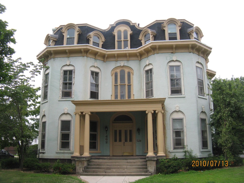
Address: 462 W 6 ST
Parcel: 17040014012800
Parcel Profile
Address
462 | W | 6 | ST
Street Status
PAVED | SIDEWALK
School District
CITY OF ERIE SCHOOL
Acreage
0.2900
Classification
A
Land Use Code
APARTMENTS 4 - 19 UNITS
Legal Description
462 W 6 ST 82.5 X 152.5 | 0.29 AC
Square Feet
5853
Topo
LEVEL
Utility
ALL PUBLIC
Zoning
Please contact your municipal zoning officer
Deed Book
2019
Deed Page
026626
2026 Tax Values
Land Value / Taxable
50,500 / 50,500.00
Building Value / Taxable
209,200 / 209,200.00
Total Value / Taxable
259,700 / 259,700.00
Clean & Green
Inactive
Homestead Status
Inactive
Farmstead Status
Inactive
Lerta Amount
0
Lerta Expiration Year
0
Commercial Data
Card 1
APARTMENTS - GARDEN
Business Living Area - 5853
Year Built - 1868
Improvement Name - APARTMENTS
Value - 155910
Other Buildings & Yards
Description
Built
Width
Length
Area
PAVING ASPHALT PARKING
2019
0
0
4500
Sales History
Sale Date
Type
Price
Book / Page
Other Info
12/24/2019
LAND & BUILDING
0
2019 / 026626
DEED
3/22/2019
LAND & BUILDING
0
2019 / 005029
CORRECTIVE DEED
12/18/2018
LAND & BUILDING
250000
2018 / 026061
SPECIAL WARRANTY DEED
7/18/2018
LAND & BUILDING
200000
2018 / 014292
SPECIAL WARRANTY DEED
3/3/2003
LAND & BUILDING
185000
981 / 2303
7/14/1988
0
0057 / 1880
Parcel Sketches
Commercial Card 1
A
MAIN
1776 square feet
B
MAIN
1981 square feet
C
MAIN
1936 square feet
D
MAIN
1936 square feet
Parcel Images
Please note:
this tab is for informational purposes only and may not show all delinquencies, see the Taxes tab for more accurate delinquent taxes due.