Elected Officials
Courts
Departments
Initiatives
Open Government
About
Login / Register
Home
/
Property & Tax Records
/
Property Records
/
Property & Tax Search
/
Parcel Profile
/
Print View
Search for Another Parcel
Parcel Profile
Historical Card
Sketches
Photos
Tax Map
Taxes
Print View
Print This Page
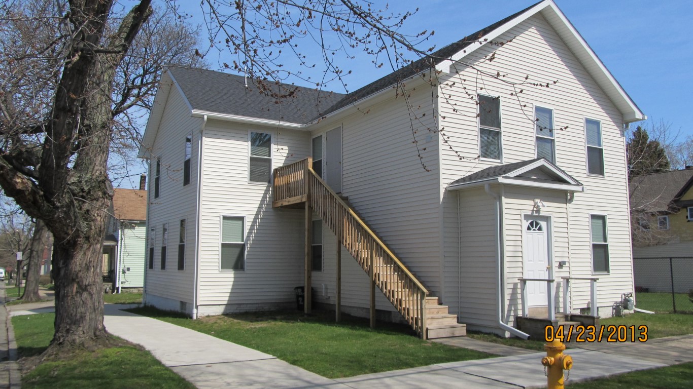
Address: 462 W 5TH ST
Parcel: 17040014022700
Parcel Profile
Address
462 | W | 5TH | ST
Street Status
PAVED | SIDEWALK
School District
CITY OF ERIE SCHOOL
Acreage
0.0644
Classification
A
Land Use Code
APARTMENTS 4 - 19 UNITS
Legal Description
462 W 5TH ST 41.25X68
Square Feet
4176
Topo
LEVEL
Utility
ALL PUBLIC
Zoning
Please contact your municipal zoning officer
Deed Book
2014
Deed Page
026322
2026 Tax Values
Land Value / Taxable
4,200 / 4,200.00
Building Value / Taxable
92,400 / 92,400.00
Total Value / Taxable
96,600 / 96,600.00
Clean & Green
Inactive
Homestead Status
Inactive
Farmstead Status
Inactive
Lerta Amount
0
Lerta Expiration Year
0
Commercial Data
Card 1
RESIDENTIAL 4 FAMILY
Business Living Area - 4176
Year Built - 1882
Improvement Name - APARTMENT
Value - 86300
Other Buildings & Yards
No OBY Data Found
Sales History
Sale Date
Type
Price
Book / Page
Other Info
12/5/2014
LAND & BUILDING
130000
2014 / 026322
SPECIAL WARRANTY DEED
5/24/2011
LAND & BUILDING
6000
2011 / 011661
DEED
6/21/1989
0
0090 / 0510
Parcel Sketches
Commercial Card 1
A
MAIN
1392 square feet
B
MAIN
1392 square feet
C
MAIN
1392 square feet
D
MAIN
693 square feet
Parcel Images
Please note:
this tab is for informational purposes only and may not show all delinquencies, see the Taxes tab for more accurate delinquent taxes due.