Elected Officials
Courts
Departments
Initiatives
Open Government
About
Login / Register
Home
/
Property & Tax Records
/
Property Records
/
Property & Tax Search
/
Parcel Profile
/
Print View
Search for Another Parcel
Parcel Profile
Historical Card
Sketches
Photos
Tax Map
Taxes
Print View
Print This Page
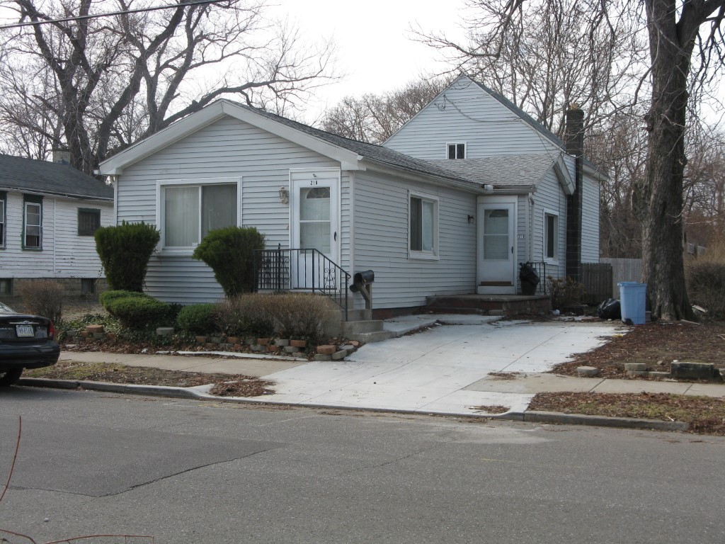
Address: 216 CHESTNUT ST
Parcel: 17040015020300
Parcel Profile
Address
216 | CHESTNUT | ST
Street Status
PAVED
School District
CITY OF ERIE SCHOOL
Acreage
0.0663
Classification
R
Land Use Code
SINGLE FAMILY
Legal Description
216 CHESTNUT ST 35X82.5
Square Feet
1176
Topo
LEVEL
Utility
ALL PUBLIC
Zoning
Please contact your municipal zoning officer
Deed Book
1481
Deed Page
1139
2026 Tax Values
Land Value / Taxable
7,000 / 7,000.00
Building Value / Taxable
24,200 / 24,200.00
Total Value / Taxable
31,200 / 31,200.00
Clean & Green
Inactive
Homestead Status
Inactive
Farmstead Status
Inactive
Lerta Amount
0
Lerta Expiration Year
0
Residential Data
Card 1
Style
RANCH
Basement
PART
Year Built
1900
Exterior Wall
ALUMINUM/VINYL
Total Living Area
1176
Full Baths
1
Half Baths
0
Fuel Type
GAS
Heating
CENTRAL
Heating System
HEAT PUMP
Stories
1.0
Total Bedrooms
3
Total Family Rooms
0
Total Rooms
7
Fireplaces
0
Other Buildings & Yards
No OBY Data Found
Sales History
Sale Date
Type
Price
Book / Page
Other Info
3/11/2008
LAND & BUILDING
0
1481 / 1139
DEED
9/12/1986
0
1648 / 0237
Parcel Sketches
Residential Card 1
A
MAIN
824 square feet
B
1S FR ONE STORY FRAME AT UN ATTIC-UNFINISHED
352 square feet
C
MA STOOP/TERR MAS STOOP
36 square feet
D
MA STOOP/TERR MAS STOOP
84 square feet
E
MA STOOP/TERR MAS STOOP
20 square feet
Parcel Images
Please note:
this tab is for informational purposes only and may not show all delinquencies, see the Taxes tab for more accurate delinquent taxes due.