Elected Officials
Courts
Departments
Initiatives
Open Government
About
Login / Register
Home
/
Property & Tax Records
/
Property Records
/
Property & Tax Search
/
Parcel Profile
/
Print View
Search for Another Parcel
Parcel Profile
Historical Card
Sketches
Photos
Tax Map
Taxes
Print View
Print This Page
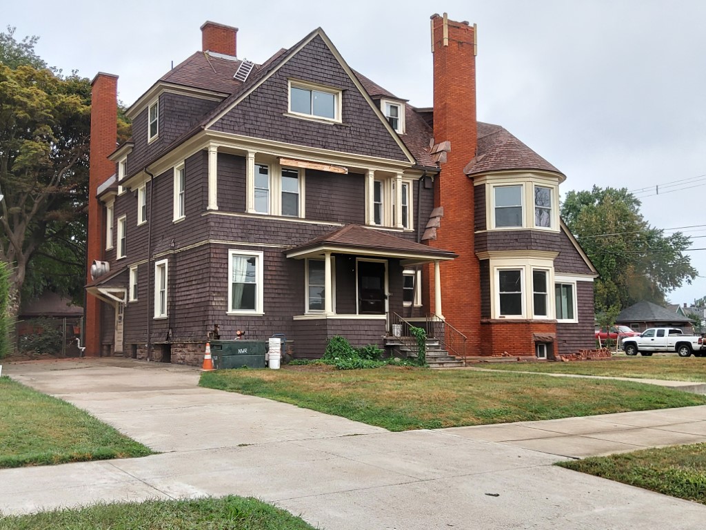
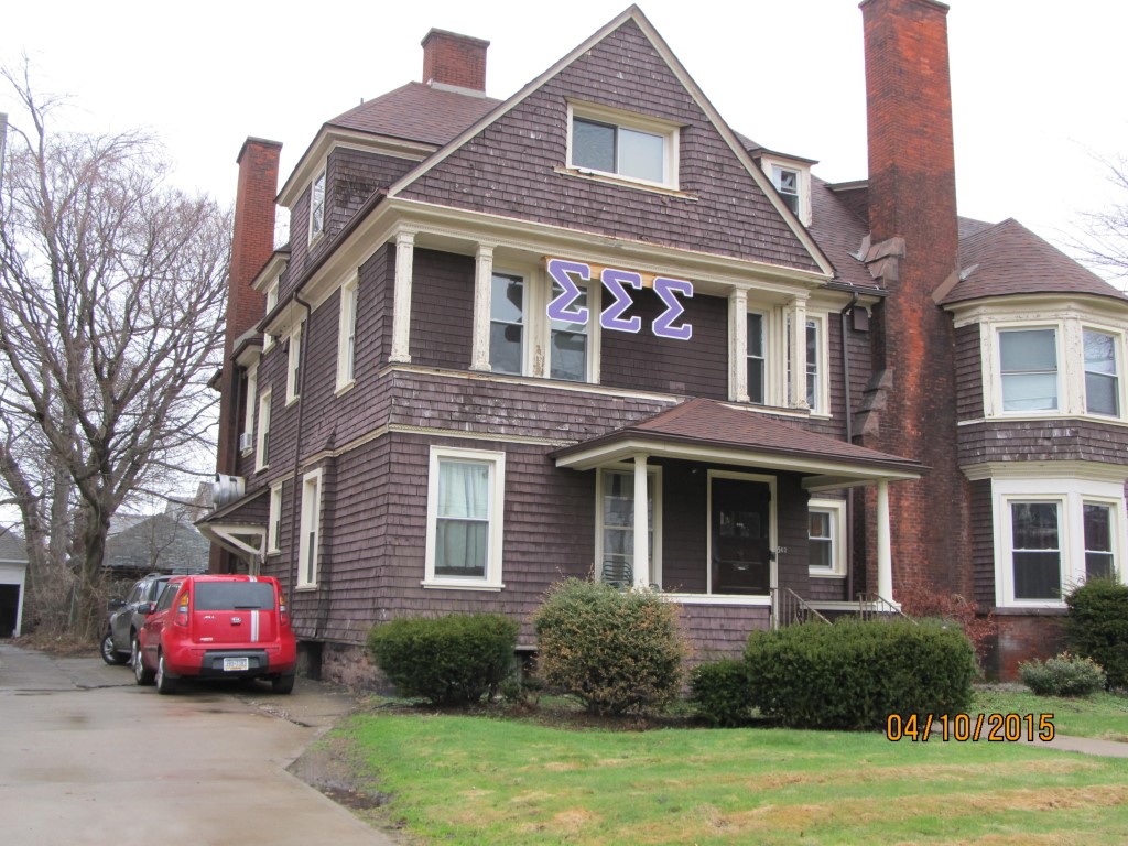
Address: 502 W 6 ST
Parcel: 17040017010000
Parcel Profile
Address
502 | W | 6 | ST
Street Status
PAVED
School District
CITY OF ERIE SCHOOL
Acreage
0.3617
Classification
C
Land Use Code
LIFE CARE FACILITIES
Legal Description
502 W 6 ST 82.5 X 191 | 0.3617 AC
Square Feet
8212
Topo
LEVEL
Utility
ALL PUBLIC
Zoning
Please contact your municipal zoning officer
Deed Book
2022
Deed Page
025569
2026 Tax Values
Land Value / Taxable
47,700 / 47,700.00
Building Value / Taxable
319,600 / 319,600.00
Total Value / Taxable
367,300 / 367,300.00
Clean & Green
Inactive
Homestead Status
Inactive
Farmstead Status
Inactive
Lerta Amount
0
Lerta Expiration Year
0
Commercial Data
Card 1
MIXED RESIDENTIAL/COMMERCIAL
Business Living Area - 8212
Year Built - 1905
Improvement Name - CORNELL ABRAXES II
Value - 299270
Other Buildings & Yards
Description
Built
Width
Length
Area
PAVING ASPHALT PARKING
1950
0
0
1595
PAVING CONCRETE AVERAGE
1950
0
0
825
FENCE CHAIN LINK
1990
150
6
900
FRAME OR CB DETACHED GARAGE
2024
0
0
1588
Sales History
Sale Date
Type
Price
Book / Page
Other Info
12/6/2022
LAND & BUILDING
0
2022 / 025569
QUIT CLAIM DEED
12/31/2019
LAND & BUILDING
400000
2019 / 027080
SPECIAL WARRANTY DEED
4/11/2014
LAND & BUILDING
271600
2014 / 006724
SPECIAL WARRANTY DEED
9/10/1997
0
0517 / 2393
Parcel Sketches
Commercial Card 1
A
MAIN
2050 square feet
B
MAIN
2420 square feet
C
MAIN
2166 square feet
D
MAIN
1553 square feet
E
MAIN
23 square feet
Parcel Images
Please note:
this tab is for informational purposes only and may not show all delinquencies, see the Taxes tab for more accurate delinquent taxes due.