Elected Officials
Courts
Departments
Initiatives
Open Government
About
Login / Register
Home
/
Property & Tax Records
/
Property Records
/
Property & Tax Search
/
Parcel Profile
/
Print View
Search for Another Parcel
Parcel Profile
Historical Card
Sketches
Photos
Tax Map
Taxes
Print View
Print This Page
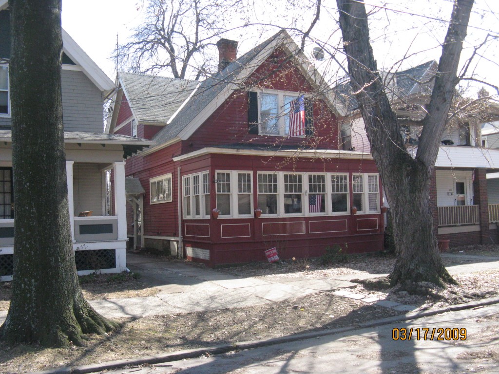
Address: 619 W 7TH ST
Parcel: 17040019010900
Parcel Profile
Address
619 | W | 7TH | ST
Street Status
PAVED
School District
CITY OF ERIE SCHOOL
Acreage
0.1212
Classification
R
Land Use Code
SINGLE FAMILY
Legal Description
619 W 7 ST 31.75X165
Square Feet
2002
Topo
LEVEL
Utility
ALL PUBLIC
Zoning
Please contact your municipal zoning officer
Deed Book
2010
Deed Page
028779
2026 Tax Values
Land Value / Taxable
8,500 / 8,500.00
Building Value / Taxable
47,500 / 47,500.00
Total Value / Taxable
56,000 / 56,000.00
Clean & Green
Inactive
Homestead Status
Active
Farmstead Status
Inactive
Lerta Amount
0
Lerta Expiration Year
0
Residential Data
Card 1
Style
OLD STYLE
Basement
PART
Year Built
1882
Exterior Wall
FRAME
Total Living Area
2002
Full Baths
1
Half Baths
1
Fuel Type
GAS
Heating
CENTRAL
Heating System
HOT WATER
Stories
1.5
Total Bedrooms
3
Total Family Rooms
0
Total Rooms
6
Fireplaces
0
Other Buildings & Yards
No OBY Data Found
Sales History
Sale Date
Type
Price
Book / Page
Other Info
11/16/2010
LAND & BUILDING
0
2010 / 028779
QUIT CLAIM DEED
1/16/1990
0
0110 / 0980
Parcel Sketches
Residential Card 1
A
MAIN
1144 square feet
B
FR UT FRAME UTILITY BUILDING
140 square feet
C
EFP ENCL FRAME PORCH
192 square feet
Parcel Images
Please note:
this tab is for informational purposes only and may not show all delinquencies, see the Taxes tab for more accurate delinquent taxes due.