Elected Officials
Courts
Departments
Initiatives
Open Government
About
Login / Register
Home
/
Property & Tax Records
/
Property Records
/
Property & Tax Search
/
Parcel Profile
/
Print View
Search for Another Parcel
Parcel Profile
Historical Card
Sketches
Photos
Tax Map
Taxes
Print View
Print This Page
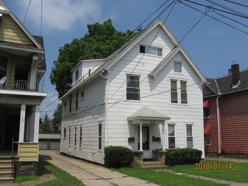
Address: 652 W 8 ST
Parcel: 17040019012900
Parcel Profile
Address
652 | W | 8 | ST
Street Status
PAVED
School District
CITY OF ERIE SCHOOL
Acreage
0.1562
Classification
A
Land Use Code
APARTMENTS 4 - 19 UNITS
Legal Description
652 W 8TH ST 41.25X165
Square Feet
4208
Topo
LEVEL
Utility
ALL PUBLIC
Zoning
Please contact your municipal zoning officer
Deed Book
1594
Deed Page
1818
2026 Tax Values
Land Value / Taxable
13,600 / 13,600.00
Building Value / Taxable
78,500 / 78,500.00
Total Value / Taxable
92,100 / 92,100.00
Clean & Green
Inactive
Homestead Status
Inactive
Farmstead Status
Inactive
Lerta Amount
0
Lerta Expiration Year
0
Commercial Data
Card 1
RESIDENTIAL 4 FAMILY
Business Living Area - 4208
Year Built - 1892
Improvement Name - APARTMENTS
Value - 68770
Other Buildings & Yards
Description
Built
Width
Length
Area
FRAME OR CB DETACHED GARAGE
1969
23
40
920
PAVING CONCRETE AVERAGE
1969
39
43
1677
Sales History
Sale Date
Type
Price
Book / Page
Other Info
10/1/2009
LAND & BUILDING
73000
1594 / 1818
WARRANTY/SURVIVORSHIP DEED
8/16/1994
0
0349 / 2167
Parcel Sketches
Commercial Card 1
A
MAIN
1168 square feet
B
MAIN
1168 square feet
C
MAIN
1168 square feet
D
MAIN
704 square feet
Parcel Images
Please note:
this tab is for informational purposes only and may not show all delinquencies, see the Taxes tab for more accurate delinquent taxes due.