Elected Officials
Courts
Departments
Initiatives
Open Government
About
Login / Register
Home
/
Property & Tax Records
/
Property Records
/
Property & Tax Search
/
Parcel Profile
/
Print View
Search for Another Parcel
Parcel Profile
Historical Card
Sketches
Photos
Tax Map
Taxes
Print View
Print This Page
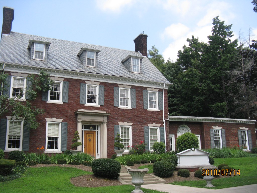
Address: 652 W 6 ST
Parcel: 17040020013100
Parcel Profile
Address
652 | W | 6 | ST
Street Status
PAVED | SIDEWALK
School District
CITY OF ERIE SCHOOL
Acreage
0.4325
Classification
C
Land Use Code
OFFICE BLDGS/LABS/LIBRARIES
Legal Description
652 W 6 ST 120X157
Square Feet
8739
Topo
LEVEL
Utility
ALL PUBLIC
Zoning
Please contact your municipal zoning officer
Deed Book
2014
Deed Page
013011
2026 Tax Values
Land Value / Taxable
75,400 / 75,400.00
Building Value / Taxable
484,600 / 484,600.00
Total Value / Taxable
560,000 / 560,000.00
Clean & Green
Inactive
Homestead Status
Inactive
Farmstead Status
Inactive
Lerta Amount
0
Lerta Expiration Year
0
Commercial Data
Card 1
MIXED RES/COMM
Business Living Area - 8739
Year Built - 1918
Improvement Name - WEALTH MANAGEMENT
Value - 476120
Other Buildings & Yards
Description
Built
Width
Length
Area
PAVING CONCRETE AVERAGE
1996
0
0
4000
Sales History
Sale Date
Type
Price
Book / Page
Other Info
6/30/2014
LAND & BUILDING
630000
2014 / 013011
DEED
7/29/2005
LAND & BUILDING
740000
1256 / 0574
WARRANTY/SURVIVORSHIP DEED
8/22/1994
0
0350 / 1649
Parcel Sketches
Commercial Card 1
A
MAIN
1951 square feet
B
MAIN
3114 square feet
C
MAIN
1837 square feet
D
MAIN
1837 square feet
Parcel Images
Please note:
this tab is for informational purposes only and may not show all delinquencies, see the Taxes tab for more accurate delinquent taxes due.