Elected Officials
Courts
Departments
Initiatives
Open Government
About
Login / Register
Home
/
Property & Tax Records
/
Property Records
/
Property & Tax Search
/
Parcel Profile
/
Print View
Search for Another Parcel
Parcel Profile
Historical Card
Sketches
Photos
Tax Map
Taxes
Print View
Print This Page
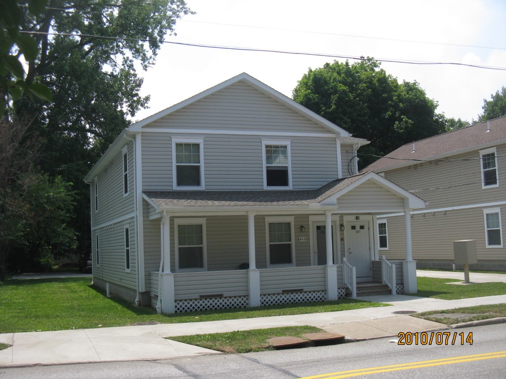
Address: 643 45 W 4 ST
Parcel: 17040020021700
Parcel Profile
Address
643 | 45 | W | 4 | ST
Street Status
PAVED
School District
CITY OF ERIE SCHOOL
Acreage
0.1837
Classification
A
Land Use Code
APARTMENTS 4 - 19 UNITS
Legal Description
643 45 W 4 ST LOT B 56.00 X 165.19 IRR | REF MB 2002-123
Square Feet
3970
Topo
LEVEL
Utility
ALL PUBLIC
Zoning
Please contact your municipal zoning officer
Deed Book
1376
Deed Page
2089
2026 Tax Values
Land Value / Taxable
16,000 / 16,000.00
Building Value / Taxable
156,400 / 156,400.00
Total Value / Taxable
172,400 / 172,400.00
Clean & Green
Inactive
Homestead Status
Inactive
Farmstead Status
Inactive
Lerta Amount
0.00
Lerta Expiration Year
2017
Commercial Data
Card 1
RESIDENTIAL 4 FAMILY
Business Living Area - 3970
Year Built - 2007
Improvement Name - HANDS CASCADE RUN 4 FAMILY
Value - 220450
Other Buildings & Yards
No OBY Data Found
Sales History
Sale Date
Type
Price
Book / Page
Other Info
11/17/2006
LAND
21600
1376 / 2089
CORPORATE DEED
3/8/2002
LAND
0
860 / 1579
AFFIDAVIT
Parcel Sketches
Commercial Card 1
A
MAIN
1334 square feet
B
MAIN
1334 square feet
C
MAIN
1302 square feet
Parcel Images
Please note:
this tab is for informational purposes only and may not show all delinquencies, see the Taxes tab for more accurate delinquent taxes due.