Elected Officials
Courts
Departments
Initiatives
Open Government
About
Login / Register
Home
/
Property & Tax Records
/
Property Records
/
Property & Tax Search
/
Parcel Profile
/
Print View
Search for Another Parcel
Parcel Profile
Historical Card
Sketches
Photos
Tax Map
Taxes
Print View
Print This Page
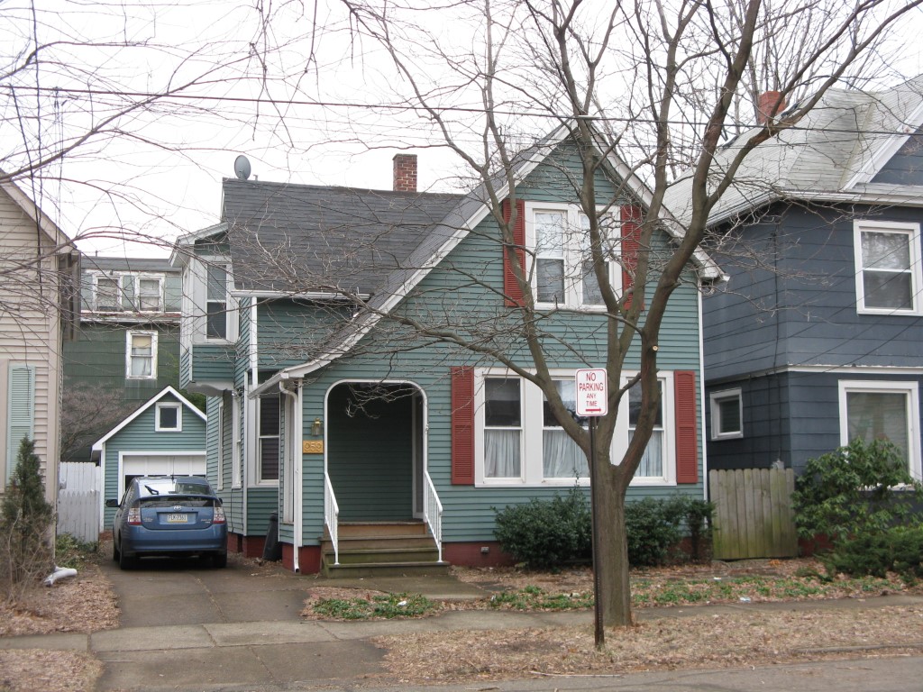
Address: 959 W 7 ST
Parcel: 17040028012400
Parcel Profile
Address
959 | W | 7 | ST
Street Status
PAVED
School District
CITY OF ERIE SCHOOL
Acreage
0.0622
Classification
R
Land Use Code
SINGLE FAMILY
Legal Description
959 W 7 ST 33X82.5
Square Feet
1308
Topo
LEVEL
Utility
ALL PUBLIC
Zoning
Please contact your municipal zoning officer
Deed Book
2020
Deed Page
012120
2026 Tax Values
Land Value / Taxable
7,200 / 7,200.00
Building Value / Taxable
57,800 / 57,800.00
Total Value / Taxable
65,000 / 65,000.00
Clean & Green
Inactive
Homestead Status
Inactive
Farmstead Status
Inactive
Lerta Amount
0
Lerta Expiration Year
0
Residential Data
Card 1
Style
OLD STYLE
Basement
FULL
Year Built
1902
Exterior Wall
ALUMINUM/VINYL
Total Living Area
1308
Full Baths
1
Half Baths
1
Fuel Type
GAS
Heating
CENTRAL A/C
Heating System
FORCED AIR
Stories
1.5
Total Bedrooms
3
Total Family Rooms
0
Total Rooms
6
Fireplaces
0
Other Buildings & Yards
Description
Built
Width
Length
Area
FRAME OR CB DETACHED GARAGE
1920
12
15
180
Sales History
Sale Date
Type
Price
Book / Page
Other Info
7/2/2020
LAND & BUILDING
50000
2020 / 012120
CORRECTIVE DEED
10/16/2019
LAND & BUILDING
50000
2019 / 021170
SPECIAL WARRANTY DEED
5/25/2004
LAND & BUILDING
93000
1138 / 0627
WARRANTY/SURVIVORSHIP DEED
10/22/1984
0
1557 / 0065
Parcel Sketches
Residential Card 1
A
MAIN
718 square feet
B
EFP ENCL FRAME PORCH
99 square feet
C
EFP ENCL FRAME PORCH
42 square feet
D
1S FR ONE STORY FRAME
30 square feet
E
FROVR FRAME OVERHANG
21 square feet
Parcel Images
Please note:
this tab is for informational purposes only and may not show all delinquencies, see the Taxes tab for more accurate delinquent taxes due.