Elected Officials
Courts
Departments
Initiatives
Open Government
About
Login / Register
Home
/
Property & Tax Records
/
Property Records
/
Property & Tax Search
/
Parcel Profile
/
Print View
Search for Another Parcel
Parcel Profile
Historical Card
Sketches
Photos
Tax Map
Taxes
Print View
Print This Page
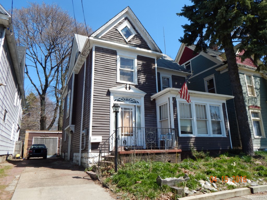
Address: 719 RASPBERRY ST
Parcel: 17040031012800
Parcel Profile
Address
719 | RASPBERRY | ST
Street Status
PAVED | SIDEWALK
School District
CITY OF ERIE SCHOOL
Acreage
0.0781
Classification
R
Land Use Code
SINGLE FAMILY
Legal Description
719 RASPBERRY ST 41.25X82.5
Square Feet
1751
Topo
LEVEL
Utility
ALL PUBLIC
Zoning
Please contact your municipal zoning officer
Deed Book
2013
Deed Page
000249
2026 Tax Values
Land Value / Taxable
7,600 / 7,600.00
Building Value / Taxable
4,900 / 4,900.00
Total Value / Taxable
12,500 / 12,500.00
Clean & Green
Inactive
Homestead Status
Active
Farmstead Status
Inactive
Lerta Amount
0
Lerta Expiration Year
0
Residential Data
Card 1
Style
OLD STYLE
Basement
FULL
Year Built
1892
Exterior Wall
FRAME
Total Living Area
1751
Full Baths
1
Half Baths
0
Fuel Type
GAS
Heating
CENTRAL
Heating System
FORCED AIR
Stories
2.0
Total Bedrooms
4
Total Family Rooms
0
Total Rooms
7
Fireplaces
0
Other Buildings & Yards
No OBY Data Found
Sales History
Sale Date
Type
Price
Book / Page
Other Info
1/3/2013
LAND & BUILDING
12500
2013 / 000249
DEED
8/5/1996
0
0454 / 0301
Parcel Sketches
Residential Card 1
A
MAIN
792 square feet
B
FROVR FRAME OVERHANG
7 square feet
C
FR UT FRAME UTILITY BUILDING
84 square feet
D
1S FR ONE STORY FRAME
40 square feet
E
1S FR ONE STORY FRAME
120 square feet
F
MA STOOP/TERR MAS STOOP
45 square feet
Parcel Images
Please note:
this tab is for informational purposes only and may not show all delinquencies, see the Taxes tab for more accurate delinquent taxes due.