Elected Officials
Courts
Departments
Initiatives
Open Government
About
Login / Register
Home
/
Property & Tax Records
/
Property Records
/
Property & Tax Search
/
Parcel Profile
/
Print View
Search for Another Parcel
Parcel Profile
Historical Card
Sketches
Photos
Tax Map
Taxes
Print View
Print This Page
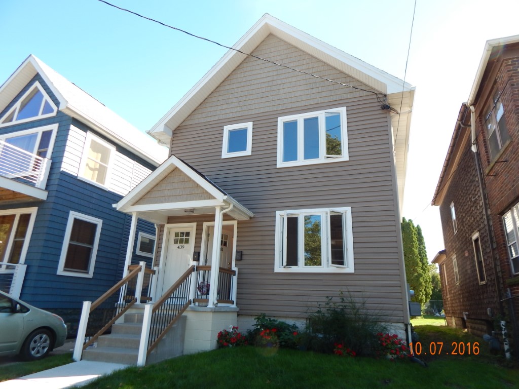
Address: 439 41 W FRONT ST
Parcel: 17040041011400
Parcel Profile
Address
439 | 41 | W | FRONT | ST
Street Status
PAVED | SIDEWALK
School District
CITY OF ERIE SCHOOL
Acreage
0.1834
Classification
R
Land Use Code
TWO FAMILY
Legal Description
439 41 W FRONT ST 45.82 X137.69 IRREG | 0.1834 AC | REF DB 74-150
Square Feet
1936
Topo
LEVEL
Utility
ALL PUBLIC
Zoning
Please contact your municipal zoning officer
Deed Book
2019
Deed Page
020331
2026 Tax Values
Land Value / Taxable
36,100 / 36,100.00
Building Value / Taxable
98,600 / 85,730.00
Total Value / Taxable
134,700 / 121,830.00
Clean & Green
Inactive
Homestead Status
Inactive
Farmstead Status
Inactive
Lerta Amount
12870.00
Lerta Expiration Year
2026
Residential Data
Card 1
Style
OLD STYLE
Basement
FULL
Year Built
1916
Exterior Wall
ALUMINUM/VINYL
Total Living Area
1936
Full Baths
2
Half Baths
0
Fuel Type
GAS
Heating
CENTRAL
Heating System
FORCED AIR
Stories
2.0
Total Bedrooms
2
Total Family Rooms
0
Total Rooms
9
Fireplaces
0
Other Buildings & Yards
Description
Built
Width
Length
Area
FOUR SIDE CLOSED WD POLE BLDG
2020
24
30
720
FOUR SIDE CLOSED WD POLE BLDG
2018
10
10
100
Sales History
Sale Date
Type
Price
Book / Page
Other Info
10/4/2019
LAND & BUILDING
0
2019 / 020331
SPECIAL WARRANTY DEED
10/1/2015
LAND & BUILDING
100000
2015 / 021920
DEED
3/23/2012
LAND & BUILDING
0
2012 / 007302
QUIT CLAIM DEED
11/20/1980
0
1404 / 0513
Parcel Sketches
Residential Card 1
A
MAIN
968 square feet
B
MA STOOP/TERR MAS STOOP
9 square feet
C
MA STOOP/TERR MAS STOOP
9 square feet
D
MA STOOP/TERR MAS STOOP
40 square feet
Parcel Images
Please note:
this tab is for informational purposes only and may not show all delinquencies, see the Taxes tab for more accurate delinquent taxes due.