Elected Officials
Courts
Departments
Initiatives
Open Government
About
Login / Register
Home
/
Property & Tax Records
/
Property Records
/
Property & Tax Search
/
Parcel Profile
/
Print View
Search for Another Parcel
Parcel Profile
Historical Card
Sketches
Photos
Tax Map
Taxes
Print View
Print This Page
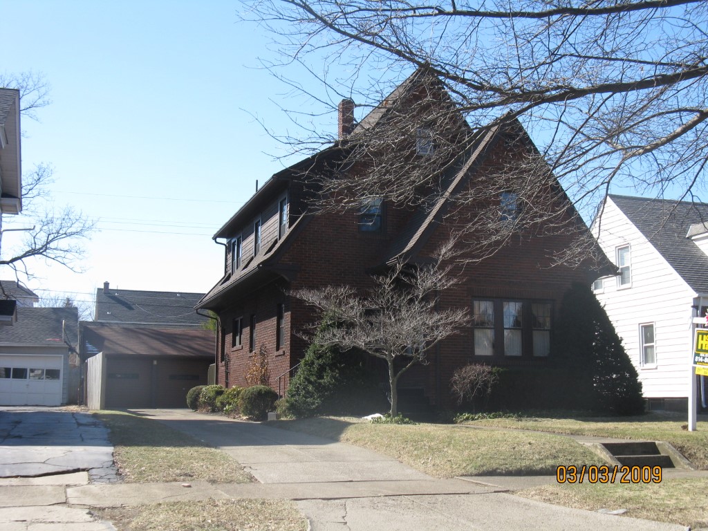
Address: 530 VERMONT AVE
Parcel: 17041019020300
Parcel Profile
Address
530 | VERMONT | AVE
Street Status
PAVED | SIDEWALK
School District
CITY OF ERIE SCHOOL
Acreage
0.1377
Classification
R
Land Use Code
SINGLE FAMILY
Legal Description
530 VERMONT AVE 50X120
Square Feet
1873
Topo
LEVEL
Utility
ALL PUBLIC
Zoning
Please contact your municipal zoning officer
Deed Book
2025
Deed Page
003175
2026 Tax Values
Land Value / Taxable
35,300 / 35,300.00
Building Value / Taxable
132,200 / 132,200.00
Total Value / Taxable
167,500 / 167,500.00
Clean & Green
Inactive
Homestead Status
Inactive
Farmstead Status
Inactive
Lerta Amount
0
Lerta Expiration Year
0
Residential Data
Card 1
Style
TUDOR
Basement
FULL
Year Built
1927
Exterior Wall
BRICK
Total Living Area
1873
Full Baths
1
Half Baths
1
Fuel Type
GAS
Heating
CENTRAL A/C
Heating System
FORCED AIR
Stories
2.0
Total Bedrooms
3
Total Family Rooms
0
Total Rooms
8
Fireplaces
1
Other Buildings & Yards
No OBY Data Found
Sales History
Sale Date
Type
Price
Book / Page
Other Info
2/28/2025
LAND & BUILDING
345000
2025 / 003175
DEED
8/15/2022
LAND & BUILDING
258000
2022 / 017805
SPECIAL WARRANTY DEED
7/2/2014
LAND & BUILDING
187000
2014 / 013403
DEED
6/16/2009
LAND & BUILDING
174500
1569 / 0088
DEED
5/6/1983
0
1493 / 0476
Parcel Sketches
Residential Card 1
A
MAIN
884 square feet
B
EMP ENCL MASONRY PORCH
35 square feet
C
WDDCK WOOD DECKS
301 square feet
D
UNFIN BSMT BASEMENT UNFINISHED 1SMAS MASONRY AT UN ATTIC-UNFINISHED
105 square feet
E
MA_PT CONC/MAS PATIO
54 square feet
Parcel Images
Please note:
this tab is for informational purposes only and may not show all delinquencies, see the Taxes tab for more accurate delinquent taxes due.