Elected Officials
Courts
Departments
Initiatives
Open Government
About
Login / Register
Home
/
Property & Tax Records
/
Property Records
/
Property & Tax Search
/
Parcel Profile
/
Print View
Search for Another Parcel
Parcel Profile
Historical Card
Sketches
Photos
Tax Map
Taxes
Print View
Print This Page
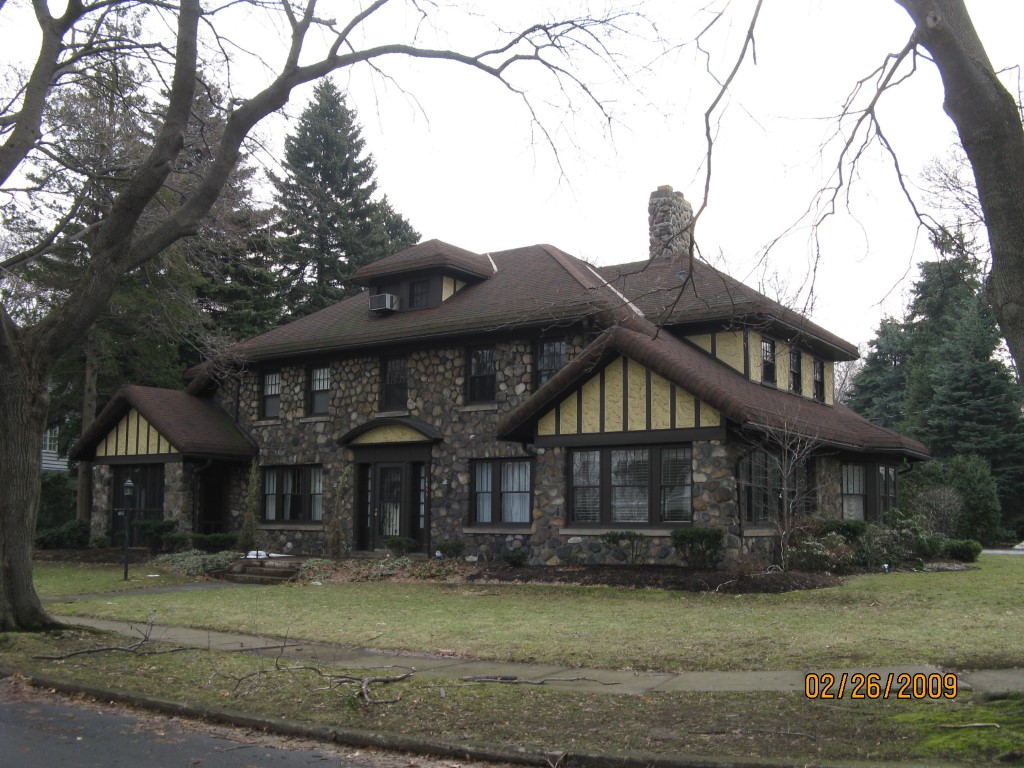
Address: 1855 S SHORE DR
Parcel: 17041026010400
Parcel Profile
Address
1855 | S | SHORE | DR
Street Status
PAVED | SIDEWALK
School District
CITY OF ERIE SCHOOL
Acreage
0.1722
Classification
R
Land Use Code
SINGLE FAMILY
Legal Description
1855 S SHORE DR IRR
Square Feet
3660
Topo
LEVEL
Utility
ALL PUBLIC
Zoning
Please contact your municipal zoning officer
Deed Book
1114
Deed Page
0686
2026 Tax Values
Land Value / Taxable
75,000 / 75,000.00
Building Value / Taxable
273,300 / 273,300.00
Total Value / Taxable
348,300 / 348,300.00
Clean & Green
Inactive
Homestead Status
Active
Farmstead Status
Inactive
Lerta Amount
0
Lerta Expiration Year
0
Residential Data
Card 1
Style
CONVENTIONAL
Basement
FULL
Year Built
1928
Exterior Wall
STONE
Total Living Area
3660
Full Baths
2
Half Baths
1
Fuel Type
GAS
Heating
CENTRAL
Heating System
HOT WATER
Stories
2.0
Total Bedrooms
5
Total Family Rooms
0
Total Rooms
10
Fireplaces
1
Other Buildings & Yards
No OBY Data Found
Sales History
Sale Date
Type
Price
Book / Page
Other Info
3/4/1974
0
1114 / 0686
Parcel Sketches
Residential Card 1
A
MAIN
1515 square feet
B
EFP ENCL FRAME PORCH
217 square feet
C
EFP ENCL FRAME PORCH
128 square feet
D
MABAY MASONRY BAY
12 square feet
E
MA_PT CONC/MAS PATIO
450 square feet
F
MG/BG MASONRY/BRICK GARAGE
324 square feet
G
MABAY MASONRY BAY
12 square feet
H
EFP ENCL FRAME PORCH
418 square feet
I
MA_PT CONC/MAS PATIO
266 square feet
Parcel Images
Please note:
this tab is for informational purposes only and may not show all delinquencies, see the Taxes tab for more accurate delinquent taxes due.