Elected Officials
Courts
Departments
Initiatives
Open Government
About
Login / Register
Home
/
Property & Tax Records
/
Property Records
/
Property & Tax Search
/
Parcel Profile
/
Print View
Search for Another Parcel
Parcel Profile
Historical Card
Sketches
Photos
Tax Map
Taxes
Print View
Print This Page
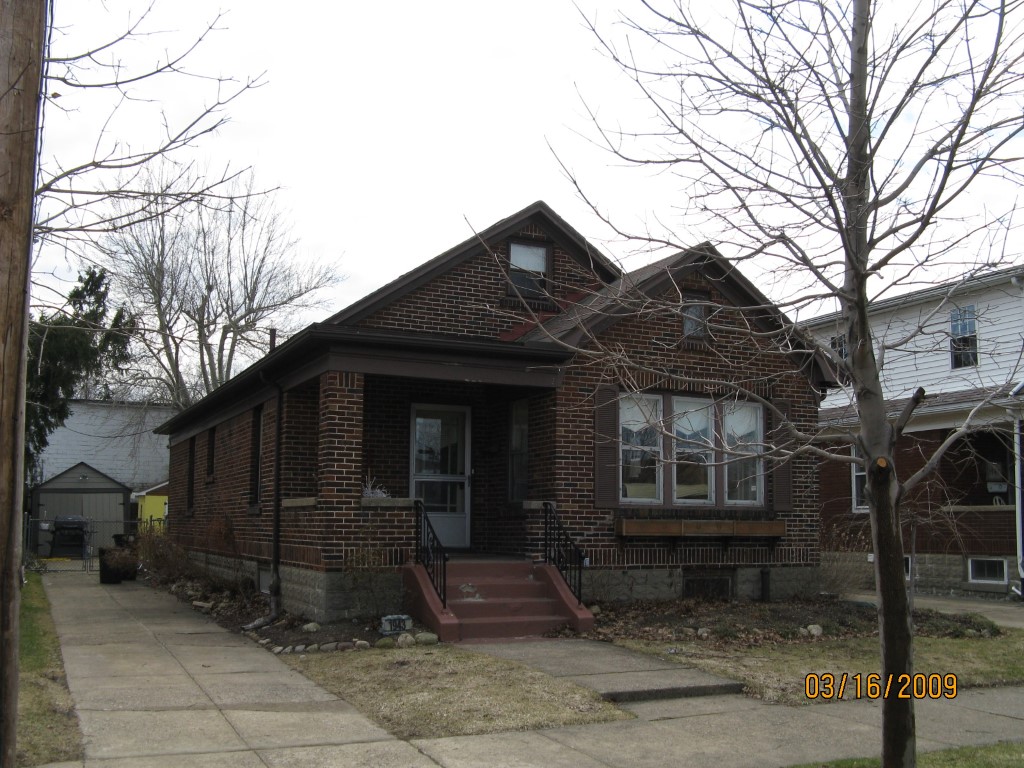
Address: 1943 OXFORD ST
Parcel: 17041028010700
Parcel Profile
Address
1943 | OXFORD | ST
Street Status
PAVED | SIDEWALK
School District
CITY OF ERIE SCHOOL
Acreage
0.1392
Classification
R
Land Use Code
SINGLE FAMILY
Legal Description
1943 OXFORD ST 42.65X170.71IR
Square Feet
1521
Topo
LEVEL
Utility
ALL PUBLIC
Zoning
Please contact your municipal zoning officer
Deed Book
0989
Deed Page
1387
2026 Tax Values
Land Value / Taxable
38,700 / 38,700.00
Building Value / Taxable
73,600 / 73,600.00
Total Value / Taxable
112,300 / 112,300.00
Clean & Green
Inactive
Homestead Status
Active
Farmstead Status
Inactive
Lerta Amount
0
Lerta Expiration Year
0
Residential Data
Card 1
Style
BUNGALOW
Basement
FULL
Year Built
1938
Exterior Wall
BRICK
Total Living Area
1521
Full Baths
1
Half Baths
0
Fuel Type
GAS
Heating
CENTRAL A/C
Heating System
FORCED AIR
Stories
1.0
Total Bedrooms
3
Total Family Rooms
0
Total Rooms
6
Fireplaces
0
Other Buildings & Yards
Description
Built
Width
Length
Area
FRAME OR CB DETACHED GARAGE
1938
10
18
180
Sales History
Sale Date
Type
Price
Book / Page
Other Info
3/25/2003
LAND & BUILDING
0
0989 / 1387
AFFIDAVIT
11/27/1989
0
0106 / 1017
Parcel Sketches
Residential Card 1
A
MAIN
936 square feet
B
OMP OPEN MASONRY PORCH
70 square feet
C
1S FR ONE STORY FRAME
280 square feet
D
UNFIN BSMT BASEMENT UNFINISHED 1SMAS MASONRY PART ATTIC FINISHED
98 square feet
E
WDDCK WOOD DECKS
24 square feet
Parcel Images
Please note:
this tab is for informational purposes only and may not show all delinquencies, see the Taxes tab for more accurate delinquent taxes due.