Elected Officials
Courts
Departments
Initiatives
Open Government
About
Login / Register
Home
/
Property & Tax Records
/
Property Records
/
Property & Tax Search
/
Parcel Profile
/
Print View
Search for Another Parcel
Parcel Profile
Historical Card
Sketches
Photos
Tax Map
Taxes
Print View
Print This Page
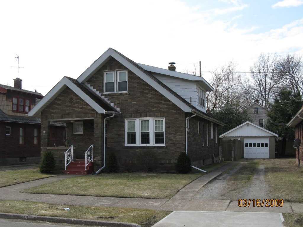
Address: 612 MARYLAND AVE
Parcel: 17041028040700
Parcel Profile
Address
612 | MARYLAND | AVE
Street Status
PAVED | SIDEWALK
School District
CITY OF ERIE SCHOOL
Acreage
0.1240
Classification
R
Land Use Code
SINGLE FAMILY
Legal Description
612 MARYLAND AVE 45X118.77
Square Feet
1553
Topo
LEVEL
Utility
ALL PUBLIC
Zoning
Please contact your municipal zoning officer
Deed Book
2020
Deed Page
022100
2026 Tax Values
Land Value / Taxable
37,400 / 37,400.00
Building Value / Taxable
62,200 / 62,200.00
Total Value / Taxable
99,600 / 99,600.00
Clean & Green
Inactive
Homestead Status
Active
Farmstead Status
Inactive
Lerta Amount
0
Lerta Expiration Year
0
Residential Data
Card 1
Style
BUNGALOW
Basement
FULL
Year Built
1932
Exterior Wall
BRICK
Total Living Area
1553
Full Baths
1
Half Baths
0
Fuel Type
GAS
Heating
CENTRAL
Heating System
HOT WATER
Stories
1.0
Total Bedrooms
4
Total Family Rooms
1
Total Rooms
6
Fireplaces
0
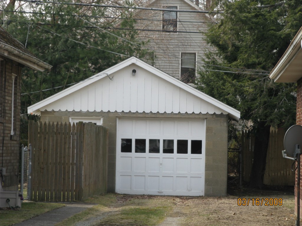
Other Buildings & Yards
No OBY Data Found
Sales History
Sale Date
Type
Price
Book / Page
Other Info
10/21/2020
LAND & BUILDING
0
2020 / 022100
SPECIAL WARRANTY DEED
5/28/2019
LAND & BUILDING
99500
2019 / 009778
SPECIAL WARRANTY DEED
3/10/2006
LAND & BUILDING
0
1311 / 2043
WARRANTY/SURVIVORSHIP DEED
3/19/2004
LAND & BUILDING
0
1116 / 2363
DEED
7/10/1989
0
0091 / 2088
Parcel Sketches
Residential Card 1
A
MAIN
995 square feet
B
OMP OPEN MASONRY PORCH
44 square feet
C
OMP OPEN MASONRY PORCH PART ATTIC FINISHED
55 square feet
D
EFP ENCL FRAME PORCH
30 square feet
Parcel Images
Please note:
this tab is for informational purposes only and may not show all delinquencies, see the Taxes tab for more accurate delinquent taxes due.