Elected Officials
Courts
Departments
Initiatives
Open Government
About
Login / Register
Home
/
Property & Tax Records
/
Property Records
/
Property & Tax Search
/
Parcel Profile
/
Print View
Search for Another Parcel
Parcel Profile
Historical Card
Sketches
Photos
Tax Map
Taxes
Print View
Print This Page
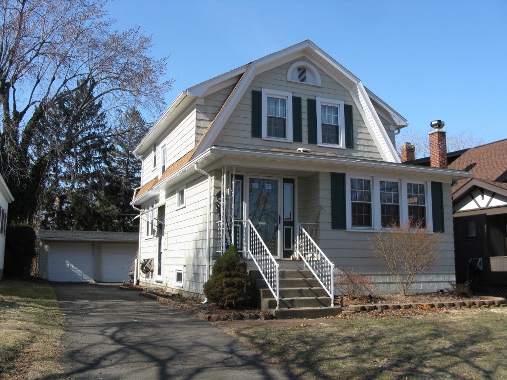
Address: 634 SHENLEY DR
Parcel: 17041031020200
Parcel Profile
Address
634 | SHENLEY | DR
Street Status
PAVED | SIDEWALK
School District
CITY OF ERIE SCHOOL
Acreage
0.1267
Classification
R
Land Use Code
SINGLE FAMILY
Legal Description
634 SHENLEY DR 40 X 138
Square Feet
1256
Topo
LEVEL
Utility
ALL PUBLIC
Zoning
Please contact your municipal zoning officer
Deed Book
2012
Deed Page
004784
2026 Tax Values
Land Value / Taxable
37,600 / 37,600.00
Building Value / Taxable
74,400 / 74,400.00
Total Value / Taxable
112,000 / 112,000.00
Clean & Green
Inactive
Homestead Status
Active
Farmstead Status
Inactive
Lerta Amount
0
Lerta Expiration Year
0
Residential Data
Card 1
Style
OLD STYLE
Basement
FULL
Year Built
1928
Exterior Wall
FRAME
Total Living Area
1256
Full Baths
2
Half Baths
0
Fuel Type
GAS
Heating
CENTRAL
Heating System
FORCED AIR
Stories
2.0
Total Bedrooms
3
Total Family Rooms
1
Total Rooms
6
Fireplaces
0
Other Buildings & Yards
Description
Built
Width
Length
Area
FRAME OR CB DETACHED GARAGE
1928
20
20
400
Sales History
Sale Date
Type
Price
Book / Page
Other Info
2/27/2012
LAND & BUILDING
90000
2012 / 004784
DEED
8/31/2007
LAND & BUILDING
110000
1444 / 1003
SPECIAL WARRANTY DEED
7/26/2000
LAND & BUILDING
99500
717 / 466
Parcel Sketches
Residential Card 1
A
MAIN
572 square feet
B
OFP OPEN FRAME PORCH
64 square feet
C
WDDCK WOOD DECKS
225 square feet
D
1S FR ONE STORY FRAME
112 square feet
Parcel Images
Please note:
this tab is for informational purposes only and may not show all delinquencies, see the Taxes tab for more accurate delinquent taxes due.