Elected Officials
Courts
Departments
Initiatives
Open Government
About
Login / Register
Home
/
Property & Tax Records
/
Property Records
/
Property & Tax Search
/
Parcel Profile
/
Print View
Search for Another Parcel
Parcel Profile
Historical Card
Sketches
Photos
Tax Map
Taxes
Print View
Print This Page
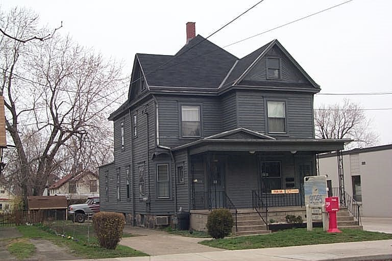
Address: 450 52 E 26 ST
Parcel: 18050019011800
Parcel Profile
Address
450 | 52 | E | 26 | ST
Street Status
PAVED | SIDEWALK
School District
CITY OF ERIE SCHOOL
Acreage
0.1609
Classification
C
Land Use Code
OFFICE BLDGS/LABS/LIBRARIES
Legal Description
450 52 E 26 ST 49 X 143
Square Feet
2556
Topo
LEVEL
Utility
ALL PUBLIC
Zoning
Please contact your municipal zoning officer
Deed Book
0001
Deed Page
2152
2026 Tax Values
Land Value / Taxable
21,000 / 21,000.00
Building Value / Taxable
24,500 / 24,500.00
Total Value / Taxable
45,500 / 45,500.00
Clean & Green
Inactive
Homestead Status
Inactive
Farmstead Status
Inactive
Lerta Amount
0
Lerta Expiration Year
0
Commercial Data
Card 1
MIXED RESIDENTIAL/COMMERCIAL
Business Living Area - 2556
Year Built - 1902
Improvement Name - GROSS REAL ESTATE
Value - 24520
Other Buildings & Yards
No OBY Data Found
Sales History
Sale Date
Type
Price
Book / Page
Other Info
3/12/1987
0
0001 / 2152
Parcel Sketches
Commercial Card 1
A
MAIN
756 square feet
B
MAIN
600 square feet
C
MAIN
444 square feet
D
MAIN
756 square feet
E
MAIN
378 square feet
Parcel Images
Please note:
this tab is for informational purposes only and may not show all delinquencies, see the Taxes tab for more accurate delinquent taxes due.