Elected Officials
Courts
Departments
Initiatives
Open Government
About
Login / Register
Home
/
Property & Tax Records
/
Property Records
/
Property & Tax Search
/
Parcel Profile
/
Print View
Search for Another Parcel
Parcel Profile
Historical Card
Sketches
Photos
Tax Map
Taxes
Print View
Print This Page
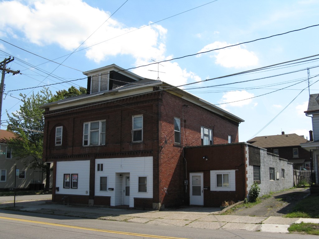
Address: 1061 63 E 26 ST
Parcel: 18050049023300
Parcel Profile
Address
1061 | 63 | E | 26 | ST
Street Status
PAVED | SIDEWALK
School District
CITY OF ERIE SCHOOL
Acreage
0.0861
Classification
A
Land Use Code
APARTMENTS 4 - 19 UNITS
Legal Description
1061 63 E 26 ST 50 X 75
Square Feet
4466
Topo
LEVEL
Utility
ALL PUBLIC
Zoning
Please contact your municipal zoning officer
Deed Book
2024
Deed Page
008817
2026 Tax Values
Land Value / Taxable
8,400 / 8,400.00
Building Value / Taxable
64,700 / 64,700.00
Total Value / Taxable
73,100 / 73,100.00
Clean & Green
Inactive
Homestead Status
Inactive
Farmstead Status
Inactive
Lerta Amount
0
Lerta Expiration Year
0
Commercial Data
Card 1
MIXED RES/COMM
Business Living Area - 4466
Year Built - 1917
Improvement Name - APARTMENTS
Value - 76110
Other Buildings & Yards
No OBY Data Found
Sales History
Sale Date
Type
Price
Book / Page
Other Info
6/11/2024
LAND & BUILDING
300000
2024 / 008817
SPECIAL WARRANTY DEED
3/1/2016
LAND & BUILDING
85000
2016 / 004149
DEED
2/22/2006
LAND & BUILDING
25600
1307 / 2154
DEED
7/27/2005
LAND & BUILDING
0
1255 / 0422
SHERIFF'S DED
6/26/2002
LAND & BUILDING
250
894 / 579
1/8/2001
LAND & BUILDING
75000
746 / 2123
Parcel Sketches
Commercial Card 1
A
MAIN
1656 square feet
B
MAIN
2810 square feet
C
MAIN
1656 square feet
Parcel Images
Please note:
this tab is for informational purposes only and may not show all delinquencies, see the Taxes tab for more accurate delinquent taxes due.