Elected Officials
Courts
Departments
Initiatives
Open Government
About
Login / Register
Home
/
Property & Tax Records
/
Property Records
/
Property & Tax Search
/
Parcel Profile
/
Print View
Search for Another Parcel
Parcel Profile
Historical Card
Sketches
Photos
Tax Map
Taxes
Print View
Print This Page
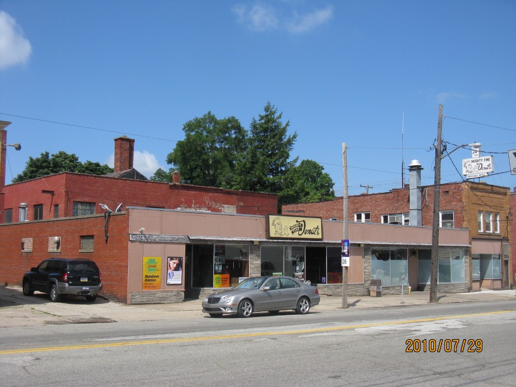
Address: 2610 PARADE ST
Parcel: 18050078020700
Parcel Profile
Address
2610 | PARADE | ST
Street Status
PAVED | SIDEWALK
School District
CITY OF ERIE SCHOOL
Acreage
0.2870
Classification
C
Land Use Code
RESTAURANTS, STORES (RETAIL)
Legal Description
2610 PARADE ST 100 X 125
Square Feet
5724
Topo
LEVEL
Utility
ALL PUBLIC
Zoning
Please contact your municipal zoning officer
Deed Book
2023
Deed Page
014576
2026 Tax Values
Land Value / Taxable
37,500 / 37,500.00
Building Value / Taxable
82,400 / 82,400.00
Total Value / Taxable
119,900 / 119,900.00
Clean & Green
Inactive
Homestead Status
Inactive
Farmstead Status
Inactive
Lerta Amount
0
Lerta Expiration Year
0
Commercial Data
Card 1
RETAIL SINGLE OCCUP
Business Living Area - 5724
Year Built - 1954
Improvement Name - MIGHTY FINE DONUTS
Value - 101610
Other Buildings & Yards
No OBY Data Found
Sales History
Sale Date
Type
Price
Book / Page
Other Info
8/31/2023
LAND & BUILDING
198000
2023 / 014576
SPECIAL WARRANTY DEED
5/12/2021
LAND & BUILDING
0
2021 / 011928
FIDUCIARY DEED
3/6/2017
LAND & BUILDING
0
2017 / 004537
QUIT CLAIM DEED
6/10/1977
0
1267 / 0029
Parcel Sketches
Commercial Card 1
A
MAIN
5040 square feet
B
MAIN
5040 square feet
C
MAIN
684 square feet
Parcel Images
Please note:
this tab is for informational purposes only and may not show all delinquencies, see the Taxes tab for more accurate delinquent taxes due.