Elected Officials
Courts
Departments
Initiatives
Open Government
About
Login / Register
Home
/
Property & Tax Records
/
Property Records
/
Property & Tax Search
/
Parcel Profile
/
Print View
Search for Another Parcel
Parcel Profile
Historical Card
Sketches
Photos
Tax Map
Taxes
Print View
Print This Page
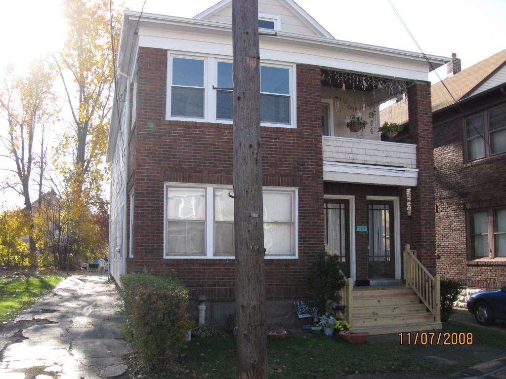
Address: 129 E 31 ST
Parcel: 18050086011600
Parcel Profile
Address
129 | E | 31 | ST
Street Status
PAVED
School District
CITY OF ERIE SCHOOL
Acreage
0.1077
Classification
R
Land Use Code
TWO FAMILY
Legal Description
129 E 31 ST 33.5 X 140
Square Feet
2576
Topo
LEVEL
Utility
ALL PUBLIC
Zoning
Please contact your municipal zoning officer
Deed Book
2025
Deed Page
001305
2026 Tax Values
Land Value / Taxable
17,300 / 17,300.00
Building Value / Taxable
64,800 / 64,800.00
Total Value / Taxable
82,100 / 82,100.00
Clean & Green
Inactive
Homestead Status
Inactive
Farmstead Status
Inactive
Lerta Amount
0
Lerta Expiration Year
0
Residential Data
Card 1
Style
OLD STYLE
Basement
FULL
Year Built
1927
Exterior Wall
COMPOSITION
Total Living Area
2576
Full Baths
2
Half Baths
0
Fuel Type
GAS
Heating
CENTRAL
Heating System
FORCED AIR
Stories
2.0
Total Bedrooms
6
Total Family Rooms
0
Total Rooms
12
Fireplaces
0
Other Buildings & Yards
No OBY Data Found
Sales History
Sale Date
Type
Price
Book / Page
Other Info
1/27/2025
LAND & BUILDING
135000
2025 / 001305
SPECIAL WARRANTY DEED
7/18/2008
LAND & BUILDING
49000
1509 / 2248
FIDUCIARY DEED
6/4/1997
0
0501 / 1710
Parcel Sketches
Residential Card 1
A
MAIN
1176 square feet
B
UNFIN BSMT BASEMENT UNFINISHED 1SMAS MASONRY 1SMAS MASONRY
112 square feet
C
MA STOOP/TERR MAS STOOP
187 square feet
D
OMP OPEN MASONRY PORCH OMP OPEN MASONRY PORCH
80 square feet
Parcel Images
Please note:
this tab is for informational purposes only and may not show all delinquencies, see the Taxes tab for more accurate delinquent taxes due.