Elected Officials
Courts
Departments
Initiatives
Open Government
About
Login / Register
Home
/
Property & Tax Records
/
Property Records
/
Property & Tax Search
/
Parcel Profile
/
Print View
Search for Another Parcel
Parcel Profile
Historical Card
Sketches
Photos
Tax Map
Taxes
Print View
Print This Page
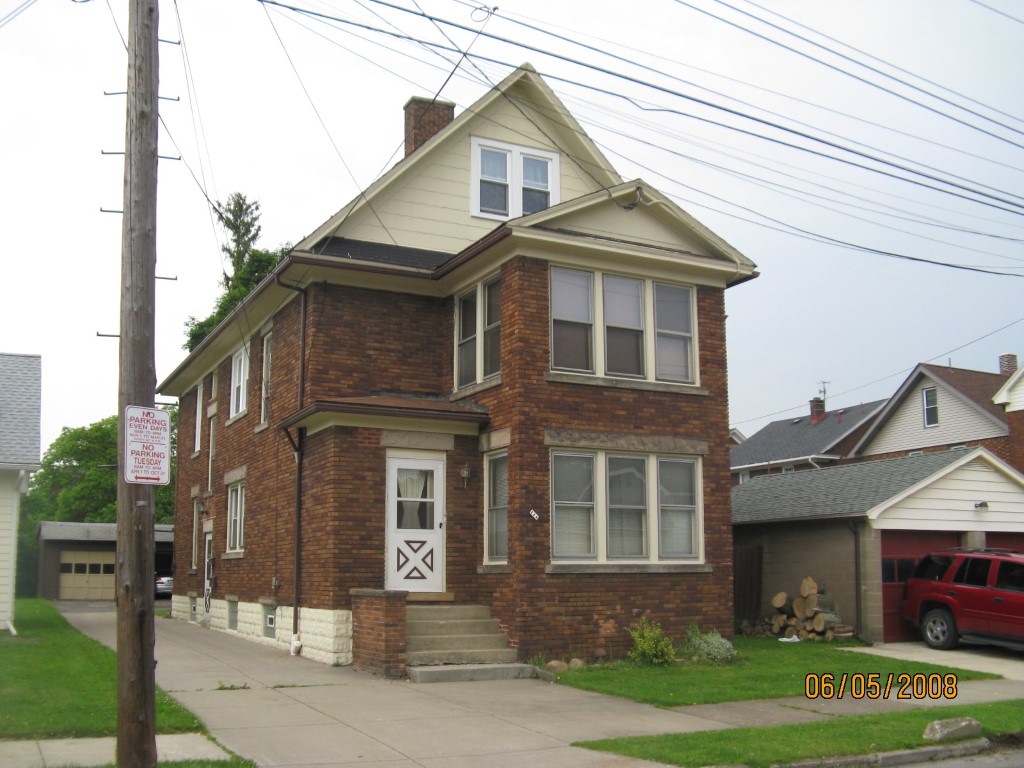
Address: 111 E 31 ST
Parcel: 18050086012000
Parcel Profile
Address
111 | E | 31 | ST
Street Status
PAVED
School District
CITY OF ERIE SCHOOL
Acreage
0.1149
Classification
R
Land Use Code
THREE FAMILY
Legal Description
111 E 31 ST 35.75 X 140
Square Feet
2818
Topo
LEVEL
Utility
ALL PUBLIC
Zoning
Please contact your municipal zoning officer
Deed Book
2024
Deed Page
013549
2026 Tax Values
Land Value / Taxable
17,400 / 17,400.00
Building Value / Taxable
84,510 / 84,510.00
Total Value / Taxable
101,910 / 101,910.00
Clean & Green
Inactive
Homestead Status
Inactive
Farmstead Status
Inactive
Lerta Amount
0
Lerta Expiration Year
0
Residential Data
Card 1
Style
OLD STYLE
Basement
FULL
Year Built
1924
Exterior Wall
BRICK
Total Living Area
2818
Full Baths
3
Half Baths
0
Fuel Type
GAS
Heating
CENTRAL
Heating System
FORCED AIR
Stories
2.0
Total Bedrooms
4
Total Family Rooms
0
Total Rooms
12
Fireplaces
0
Other Buildings & Yards
No OBY Data Found
Sales History
Sale Date
Type
Price
Book / Page
Other Info
8/27/2024
LAND & BUILDING
129900
2024 / 013549
SPECIAL WARRANTY DEED
11/24/2021
LAND & BUILDING
110000
2021 / 031381
SPECIAL WARRANTY DEED
6/24/2010
LAND & BUILDING
105000
2010 / 015069
DEED
1/29/2004
LAND & BUILDING
0
1104 / 0013
QUIT CLAIM DEED
9/30/1998
0
0590 / 2016
Parcel Sketches
Residential Card 1
A
MAIN
1050 square feet
B
EMP ENCL MASONRY PORCH
32 square feet
C
1SMAS MASONRY 1SMAS MASONRY
104 square feet
D
1S FR ONE STORY FRAME
300 square feet
Parcel Images
Please note:
this tab is for informational purposes only and may not show all delinquencies, see the Taxes tab for more accurate delinquent taxes due.