Elected Officials
Courts
Departments
Initiatives
Open Government
About
Login / Register
Home
/
Property & Tax Records
/
Property Records
/
Property & Tax Search
/
Parcel Profile
/
Print View
Search for Another Parcel
Parcel Profile
Historical Card
Sketches
Photos
Tax Map
Taxes
Print View
Print This Page
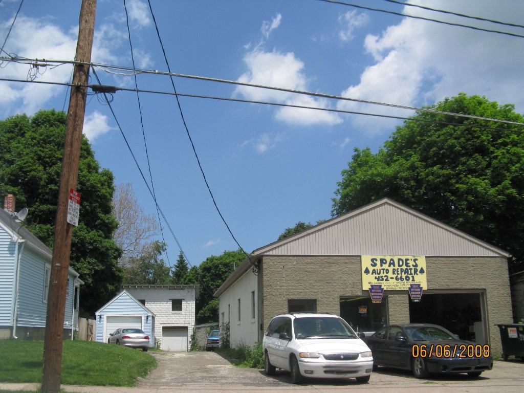
Address: 112 MOORHEAD ST
Parcel: 18050090015000
Parcel Profile
Address
112 | MOORHEAD | ST
Street Status
PAVED | SIDEWALK
School District
CITY OF ERIE SCHOOL
Acreage
0.2072
Classification
C
Land Use Code
GARAGES/SHOP/CAR DEALERS
Legal Description
112 MOORHEAD ST IRR
Square Feet
4212
Topo
LEVEL
Utility
ALL PUBLIC
Zoning
Please contact your municipal zoning officer
Deed Book
2021
Deed Page
024266
2026 Tax Values
Land Value / Taxable
27,100 / 27,100.00
Building Value / Taxable
22,900 / 22,900.00
Total Value / Taxable
50,000 / 50,000.00
Clean & Green
Inactive
Homestead Status
Inactive
Farmstead Status
Inactive
Lerta Amount
0
Lerta Expiration Year
0
Commercial Data
Card 1
AUTO SERVICE GARAGE
Business Living Area - 2100
Year Built - 1955
Improvement Name - SPADES AUTO REPAIR
Value - 19010
Card 2
WAREHOUSE
Business Living Area - 2112
Year Built - 1929
Improvement Name - LENNY'S RADIATOR AND AC SERVIC
Value - 23790
Other Buildings & Yards
No OBY Data Found
Sales History
Sale Date
Type
Price
Book / Page
Other Info
9/10/2021
LAND & BUILDING
39000
2021 / 024266
FIDUCIARY DEED
8/6/2009
LAND & BUILDING
0
1582 / 0392
DEED
1/28/1983
0
1484 / 0179
Parcel Sketches
Commercial Card 1
A
MAIN
2100 square feet
Commercial Card 2
A
MAIN
1056 square feet
B
MAIN
1056 square feet
Parcel Images
Please note:
this tab is for informational purposes only and may not show all delinquencies, see the Taxes tab for more accurate delinquent taxes due.