Elected Officials
Courts
Departments
Initiatives
Open Government
About
Login / Register
Home
/
Property & Tax Records
/
Property Records
/
Property & Tax Search
/
Parcel Profile
/
Print View
Search for Another Parcel
Parcel Profile
Historical Card
Sketches
Photos
Tax Map
Taxes
Print View
Print This Page
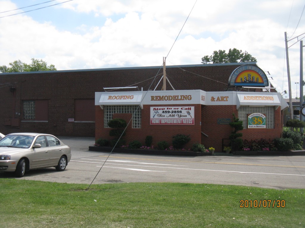
Address: 2325 BROAD ST
Parcel: 18051007010000
Parcel Profile
Address
2325 | BROAD | ST
Street Status
PAVED | SIDEWALK
School District
CITY OF ERIE SCHOOL
Acreage
1.8294
Classification
C
Land Use Code
WAREHOUSES
Legal Description
2325 BROAD ST 76689 SQ FT
Square Feet
38498
Topo
LEVEL
Utility
ALL PUBLIC
Zoning
Please contact your municipal zoning officer
Deed Book
2013
Deed Page
010816
2026 Tax Values
Land Value / Taxable
64,000 / 64,000.00
Building Value / Taxable
312,700 / 312,700.00
Total Value / Taxable
376,700 / 376,700.00
Clean & Green
Inactive
Homestead Status
Inactive
Farmstead Status
Inactive
Lerta Amount
0
Lerta Expiration Year
0
Commercial Data
Card 1
WAREHOUSE
Business Living Area - 38498
Year Built - 1954
Improvement Name - BRAENDAL PAINTING
Value - 308640
Other Buildings & Yards
Description
Built
Width
Length
Area
PAVING ASPHALT PARKING
1985
0
0
4000
Sales History
Sale Date
Type
Price
Book / Page
Other Info
5/3/2013
LAND & BUILDING
0
2013 / 010816
DEED
11/18/2002
LAND & BUILDING
0
946 / 954
AFFIDAVIT
11/21/1997
0
0530 / 1104
Parcel Sketches
Commercial Card 1
A
MAIN
36998 square feet
B
MAIN
1500 square feet
Parcel Images
Please note:
this tab is for informational purposes only and may not show all delinquencies, see the Taxes tab for more accurate delinquent taxes due.