Elected Officials
Courts
Departments
Initiatives
Open Government
About
Login / Register
Home
/
Property & Tax Records
/
Property Records
/
Property & Tax Search
/
Parcel Profile
/
Print View
Search for Another Parcel
Parcel Profile
Historical Card
Sketches
Photos
Tax Map
Taxes
Print View
Print This Page
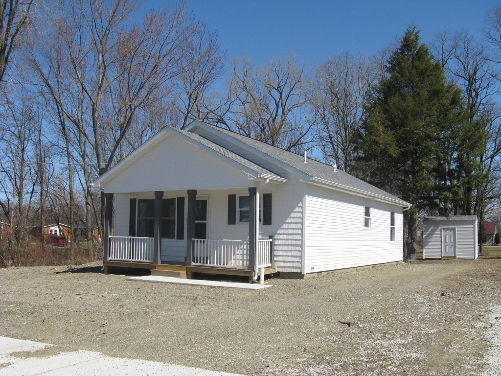
Address: 2717 PEAR ST
Parcel: 18051021011500
Parcel Profile
Address
2717 | PEAR | ST
Street Status
PAVED
School District
CITY OF ERIE SCHOOL
Acreage
0.1540
Classification
R
Land Use Code
SINGLE FAMILY
Legal Description
2717 PEAR ST LOT A 47.56 X 141 | 0.1540 AC | REF MB 1-97
Square Feet
1120
Topo
LEVEL
Utility
ALL PUBLIC
Zoning
Please contact your municipal zoning officer
Deed Book
2019
Deed Page
026687
2026 Tax Values
Land Value / Taxable
18,000 / 18,000.00
Building Value / Taxable
63,200 / 37,920.00
Total Value / Taxable
81,200 / 55,920.00
Clean & Green
Inactive
Homestead Status
Inactive
Farmstead Status
Inactive
Lerta Amount
25280.00
Lerta Expiration Year
2029
Residential Data
Card 1
Style
RANCH
Basement
NONE
Year Built
2019
Exterior Wall
ALUMINUM/VINYL
Total Living Area
1120
Full Baths
2
Half Baths
0
Fuel Type
GAS
Heating
CENTRAL
Heating System
FORCED AIR
Stories
1.0
Total Bedrooms
4
Total Family Rooms
1
Total Rooms
6
Fireplaces
0
Other Buildings & Yards
No OBY Data Found
Sales History
Sale Date
Type
Price
Book / Page
Other Info
12/27/2019
LAND & BUILDING
88500
2019 / 026687
DEED
9/16/2015
LAND & BUILDING
0
2015 / 020319
DEED
11/7/2014
LAND & BUILDING
12862
2014 / 024014
SHERIFF'S DED
11/21/2005
LAND & BUILDING
19500
1288 / 2025
WARRANTY/SURVIVORSHIP DEED
10/4/1978
0
1323 / 0402
Parcel Sketches
Residential Card 1
A
MAIN
1040 square feet
B
OFP OPEN FRAME PORCH
100 square feet
C
WDDCK WOOD DECKS
25 square feet
D
1S FR ONE STORY FRAME
80 square feet
Parcel Images
Please note:
this tab is for informational purposes only and may not show all delinquencies, see the Taxes tab for more accurate delinquent taxes due.