Elected Officials
Courts
Departments
Initiatives
Open Government
About
Login / Register
Home
/
Property & Tax Records
/
Property Records
/
Property & Tax Search
/
Parcel Profile
/
Print View
Search for Another Parcel
Parcel Profile
Historical Card
Sketches
Photos
Tax Map
Taxes
Print View
Print This Page
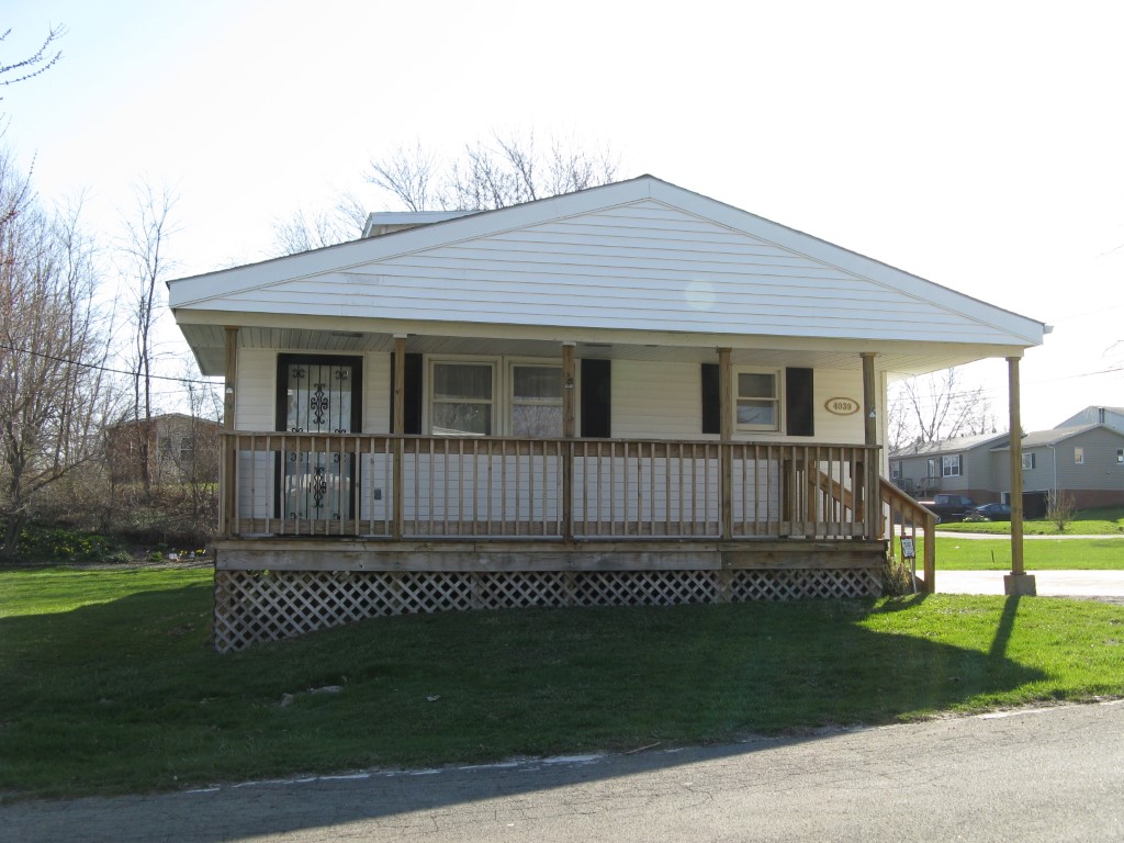
Address: 4039 STANTON ST
Parcel: 18052027030800
Parcel Profile
Address
4039 | STANTON | ST
Street Status
PAVED
School District
CITY OF ERIE SCHOOL
Acreage
0.1313
Classification
R
Land Use Code
SINGLE FAMILY
Legal Description
4039 STANTON ST 44 X 130
Square Feet
1575
Topo
LEVEL
Utility
ALL PUBLIC
Zoning
Please contact your municipal zoning officer
Deed Book
0036
Deed Page
0308
2026 Tax Values
Land Value / Taxable
18,800 / 18,800.00
Building Value / Taxable
59,900 / 59,900.00
Total Value / Taxable
78,700 / 78,700.00
Clean & Green
Inactive
Homestead Status
Active
Farmstead Status
Inactive
Lerta Amount
0
Lerta Expiration Year
0
Residential Data
Card 1
Style
CAPE
Basement
FULL
Year Built
1923
Exterior Wall
ALUMINUM/VINYL
Total Living Area
1575
Full Baths
1
Half Baths
0
Fuel Type
GAS
Heating
CENTRAL A/C
Heating System
FORCED AIR
Stories
1.0
Total Bedrooms
3
Total Family Rooms
0
Total Rooms
5
Fireplaces
1
Other Buildings & Yards
Description
Built
Width
Length
Area
FRAME OR CB DETACHED GARAGE
1945
14
32
448
Sales History
Sale Date
Type
Price
Book / Page
Other Info
12/9/1987
0
0036 / 0308
Parcel Sketches
Residential Card 1
A
MAIN
748 square feet
B
1S FR ONE STORY FRAME
320 square feet
C
1S FR ONE STORY FRAME
208 square feet
D
OFP OPEN FRAME PORCH
176 square feet
E
WDDCK WOOD DECKS
186 square feet
F
CANPY CANOPY
40 square feet
Parcel Images
Please note:
this tab is for informational purposes only and may not show all delinquencies, see the Taxes tab for more accurate delinquent taxes due.