Elected Officials
Courts
Departments
Initiatives
Open Government
About
Login / Register
Home
/
Property & Tax Records
/
Property Records
/
Property & Tax Search
/
Parcel Profile
/
Print View
Search for Another Parcel
Parcel Profile
Historical Card
Sketches
Photos
Tax Map
Taxes
Print View
Print This Page
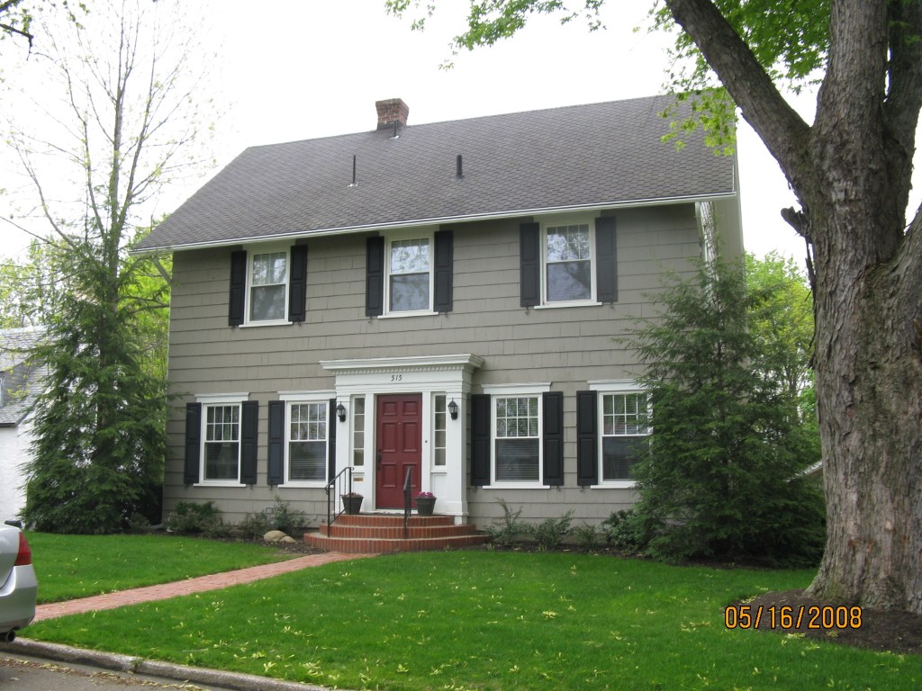
Address: 515 GORDON ST
Parcel: 18053014010200
Parcel Profile
Address
515 | GORDON | ST
Street Status
PAVED
School District
CITY OF ERIE SCHOOL
Acreage
0.5107
Classification
R
Land Use Code
SINGLE FAMILY
Legal Description
515 GORDON ST 80XIRR
Square Feet
1920
Topo
LEVEL
Utility
ALL PUBLIC
Zoning
Please contact your municipal zoning officer
Deed Book
2018
Deed Page
012670
2026 Tax Values
Land Value / Taxable
59,500 / 59,500.00
Building Value / Taxable
113,400 / 113,400.00
Total Value / Taxable
172,900 / 172,900.00
Clean & Green
Inactive
Homestead Status
Active
Farmstead Status
Inactive
Lerta Amount
0
Lerta Expiration Year
0
Residential Data
Card 1
Style
CONVENTIONAL
Basement
FULL
Year Built
1926
Exterior Wall
FRAME
Total Living Area
1920
Full Baths
1
Half Baths
1
Fuel Type
GAS
Heating
CENTRAL
Heating System
FORCED AIR
Stories
2.0
Total Bedrooms
3
Total Family Rooms
0
Total Rooms
6
Fireplaces
0
Other Buildings & Yards
No OBY Data Found
Sales History
Sale Date
Type
Price
Book / Page
Other Info
6/27/2018
LAND & BUILDING
204800
2018 / 012670
DEED
6/17/2013
LAND & BUILDING
175000
2013 / 015094
SPECIAL WARRANTY DEED
9/30/2004
LAND & BUILDING
182500
1177 / 2371
SPECIAL WARRANTY DEED
12/7/2001
LAND & BUILDING
185000
832 / 1309
Parcel Sketches
Residential Card 1
A
MAIN
768 square feet
B
UNFIN BSMT BASEMENT UNFINISHED 1S FR ONE STORY FRAME
120 square feet
C
WDDCK WOOD DECKS
276 square feet
D
UNFIN BSMT BASEMENT UNFINISHED 1S FR ONE STORY FRAME
264 square feet
E
EFP ENCL FRAME PORCH
7 square feet
F
MA STOOP/TERR MAS STOOP
15 square feet
Parcel Images
Please note:
this tab is for informational purposes only and may not show all delinquencies, see the Taxes tab for more accurate delinquent taxes due.