Elected Officials
Courts
Departments
Initiatives
Open Government
About
Login / Register
Home
/
Property & Tax Records
/
Property Records
/
Property & Tax Search
/
Parcel Profile
/
Print View
Search for Another Parcel
Parcel Profile
Historical Card
Sketches
Photos
Tax Map
Taxes
Print View
Print This Page
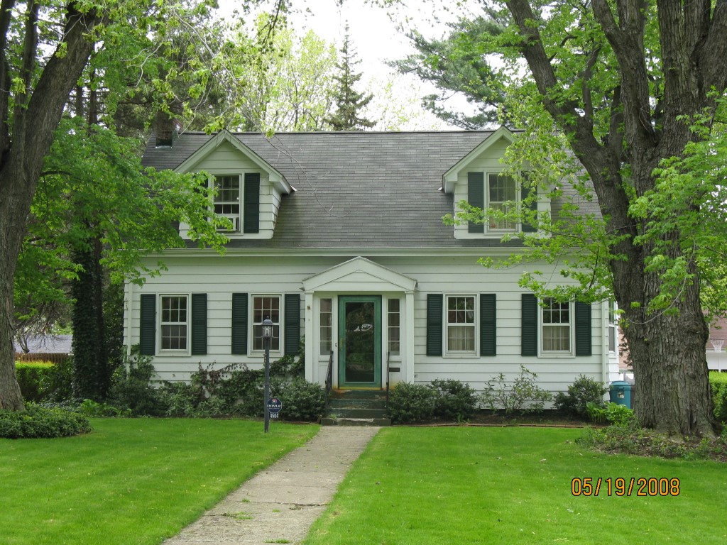
Address: 4504 UPLAND DR
Parcel: 18053018020300
Parcel Profile
Address
4504 | UPLAND | DR
Street Status
PAVED | ALLEY
School District
CITY OF ERIE SCHOOL
Acreage
0.1727
Classification
R
Land Use Code
SINGLE FAMILY
Legal Description
4504 UPLAND DR 65 X 120.69
Square Feet
1273
Topo
LEVEL
Utility
ALL PUBLIC
Zoning
Please contact your municipal zoning officer
Deed Book
2020
Deed Page
009649
2026 Tax Values
Land Value / Taxable
44,500 / 44,500.00
Building Value / Taxable
87,480 / 87,480.00
Total Value / Taxable
131,980 / 131,980.00
Clean & Green
Inactive
Homestead Status
Active
Farmstead Status
Inactive
Lerta Amount
0
Lerta Expiration Year
0
Residential Data
Card 1
Style
CONVENTIONAL
Basement
FULL
Year Built
1938
Exterior Wall
ALUMINUM/VINYL
Total Living Area
1273
Full Baths
1
Half Baths
1
Fuel Type
GAS
Heating
CENTRAL A/C
Heating System
FORCED AIR
Stories
1.0
Total Bedrooms
2
Total Family Rooms
1
Total Rooms
7
Fireplaces
1
Other Buildings & Yards
Description
Built
Width
Length
Area
FRAME OR CB DETACHED GARAGE
1938
22
20
440
Sales History
Sale Date
Type
Price
Book / Page
Other Info
6/2/2020
LAND & BUILDING
125000
2020 / 009649
SPECIAL WARRANTY DEED
4/10/1995
0
0379 / 0026
Parcel Sketches
Residential Card 1
A
MAIN
864 square feet
B
UNFIN BSMT BASEMENT UNFINISHED 1S FR ONE STORY FRAME
140 square feet
C
UNFIN BSMT BASEMENT UNFINISHED 1S FR ONE STORY FRAME
72 square feet
D
WDDCK WOOD DECKS
274 square feet
E
EFP ENCL FRAME PORCH
60 square feet
F
UNFIN BSMT BASEMENT UNFINISHED FRBAY FRAME BAY
24 square feet
G
EFP ENCL FRAME PORCH
32 square feet
Parcel Images
Please note:
this tab is for informational purposes only and may not show all delinquencies, see the Taxes tab for more accurate delinquent taxes due.