Elected Officials
Courts
Departments
Initiatives
Open Government
About
Login / Register
Home
/
Property & Tax Records
/
Property Records
/
Property & Tax Search
/
Parcel Profile
/
Print View
Search for Another Parcel
Parcel Profile
Historical Card
Sketches
Photos
Tax Map
Taxes
Print View
Print This Page
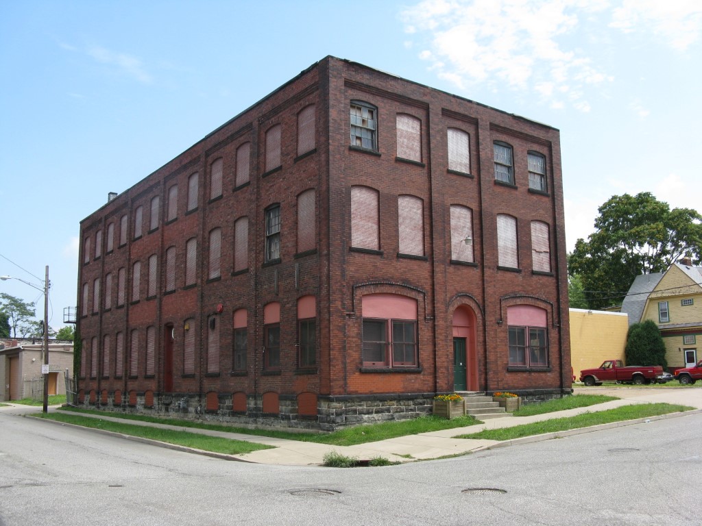
Address: 1901 MYRTLE ST
Parcel: 19060005011200
Parcel Profile
Address
1901 | MYRTLE | ST
Street Status
PAVED | SIDEWALK
School District
CITY OF ERIE SCHOOL
Acreage
0.3719
Classification
C
Land Use Code
WAREHOUSES
Legal Description
1901 MYRTLE ST 120 X 135
Square Feet
16604
Topo
LEVEL
Utility
ALL PUBLIC
Zoning
Please contact your municipal zoning officer
Deed Book
2018
Deed Page
003226
2026 Tax Values
Land Value / Taxable
32,400 / 32,400.00
Building Value / Taxable
63,100 / 63,100.00
Total Value / Taxable
95,500 / 95,500.00
Clean & Green
Inactive
Homestead Status
Inactive
Farmstead Status
Inactive
Lerta Amount
0
Lerta Expiration Year
0
Commercial Data
Card 1
WAREHOUSE
Business Living Area - 16604
Year Built - 1904
Improvement Name - RYAN MOVING AND STORAGE
Value - 105170
Other Buildings & Yards
No OBY Data Found
Sales History
Sale Date
Type
Price
Book / Page
Other Info
2/20/2018
LAND & BUILDING
0
2018 / 003226
TAX DEED
7/13/1971
0
1047 / 0618
Parcel Sketches
Commercial Card 1
A
MAIN
4018 square feet
B
MAIN
3034 square feet
C
MAIN
984 square feet
D
MAIN
4018 square feet
E
MAIN
4018 square feet
F
MAIN
4550 square feet
Parcel Images
Please note:
this tab is for informational purposes only and may not show all delinquencies, see the Taxes tab for more accurate delinquent taxes due.