Elected Officials
Courts
Departments
Initiatives
Open Government
About
Login / Register
Home
/
Property & Tax Records
/
Property Records
/
Property & Tax Search
/
Parcel Profile
/
Print View
Search for Another Parcel
Parcel Profile
Historical Card
Sketches
Photos
Tax Map
Taxes
Print View
Print This Page
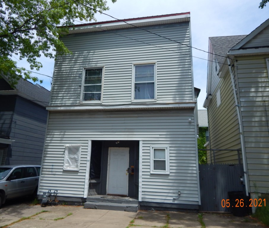
Address: 1921 MYRTLE ST
Parcel: 19060005011500
Parcel Profile
Address
1921 | MYRTLE | ST
Street Status
PAVED | SIDEWALK
School District
CITY OF ERIE SCHOOL
Acreage
0.0992
Classification
R
Land Use Code
SINGLE FAMILY
Legal Description
1921 MYRTLE ST 36X120
Square Feet
2760
Topo
LEVEL
Utility
ALL PUBLIC
Zoning
Please contact your municipal zoning officer
Deed Book
2021
Deed Page
006414
2026 Tax Values
Land Value / Taxable
10,800 / 10,800.00
Building Value / Taxable
21,525 / 21,525.00
Total Value / Taxable
32,325 / 32,325.00
Clean & Green
Inactive
Homestead Status
Active
Farmstead Status
Inactive
Lerta Amount
0
Lerta Expiration Year
0
Residential Data
Card 2
Style
OLD STYLE
Basement
FULL
Year Built
1902
Exterior Wall
ALUMINUM/VINYL
Total Living Area
2760
Full Baths
1
Half Baths
0
Fuel Type
GAS
Heating
CENTRAL
Heating System
FORCED AIR
Stories
2.0
Total Bedrooms
3
Total Family Rooms
0
Total Rooms
8
Fireplaces
0
Other Buildings & Yards
No OBY Data Found
Sales History
Sale Date
Type
Price
Book / Page
Other Info
3/18/2021
LAND & BUILDING
15000
2021 / 006414
QUIT CLAIM DEED
9/11/2019
LAND & BUILDING
2500
2019 / 018139
SPECIAL WARRANTY DEED
7/14/2015
LAND & BUILDING
5000
2015 / 014854
QUIT CLAIM DEED
8/3/2006
LAND & BUILDING
50000
1350 / 0505
WARRANTY/SURVIVORSHIP DEED
8/29/2003
LAND & BUILDING
12500
1058 / 603
WARRANTY/SURVIVORSHIP DEED
8/1/1988
0
0059 / 1156
Parcel Sketches
Residential Card 2
A
MAIN
1364 square feet
B
FRBAY FRAME BAY
16 square feet
C
FRBAY FRAME BAY
16 square feet
Parcel Images
Please note:
this tab is for informational purposes only and may not show all delinquencies, see the Taxes tab for more accurate delinquent taxes due.