Elected Officials
Courts
Departments
Initiatives
Open Government
About
Login / Register
Home
/
Property & Tax Records
/
Property Records
/
Property & Tax Search
/
Parcel Profile
/
Print View
Search for Another Parcel
Parcel Profile
Historical Card
Sketches
Photos
Tax Map
Taxes
Print View
Print This Page
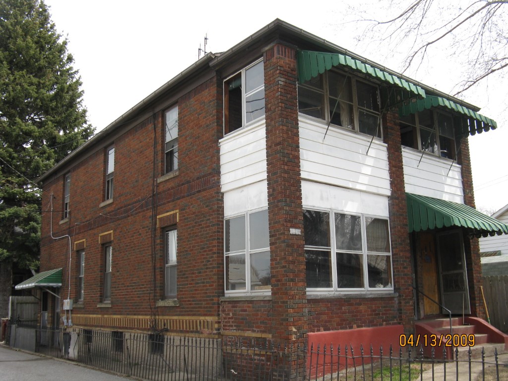
Address: 1817 B CHESTNUT ST
Parcel: 19060009023500
Parcel Profile
Address
1817 | B | CHESTNUT | ST
Street Status
ALLEY
School District
CITY OF ERIE SCHOOL
Acreage
0.1265
Classification
R
Land Use Code
TWO FAMILY
Legal Description
1817 B CHESTNUT ST 41.25X133.56
Square Feet
1760
Topo
LEVEL
Utility
ALL PUBLIC
Zoning
Please contact your municipal zoning officer
Deed Book
1050
Deed Page
747
2026 Tax Values
Land Value / Taxable
11,200 / 11,200.00
Building Value / Taxable
20,330 / 20,330.00
Total Value / Taxable
31,530 / 31,530.00
Clean & Green
Inactive
Homestead Status
Inactive
Farmstead Status
Inactive
Lerta Amount
0
Lerta Expiration Year
0
Residential Data
Card 1
Style
OLD STYLE
Basement
FULL
Year Built
1882
Exterior Wall
BRICK
Total Living Area
1760
Full Baths
2
Half Baths
0
Fuel Type
GAS
Heating
CENTRAL
Heating System
FORCED AIR
Stories
2.0
Total Bedrooms
4
Total Family Rooms
0
Total Rooms
8
Fireplaces
0
Other Buildings & Yards
No OBY Data Found
Sales History
Sale Date
Type
Price
Book / Page
Other Info
8/13/2003
LAND & BUILDING
23500
1050 / 747
SPECIAL WARRANTY DEED
7/23/2003
LAND & BUILDING
21500
1040 / 0374
WARRANTY/SURVIVORSHIP DEED
12/31/1986
0
1664 / 0372
Parcel Sketches
Residential Card 1
A
MAIN
880 square feet
B
EMP ENCL MASONRY PORCH EFP ENCL FRAME PORCH
30 square feet
C
OMP OPEN MASONRY PORCH EFP ENCL FRAME PORCH
30 square feet
D
EMP ENCL MASONRY PORCH EFP ENCL FRAME PORCH
60 square feet
Parcel Images
Please note:
this tab is for informational purposes only and may not show all delinquencies, see the Taxes tab for more accurate delinquent taxes due.