Elected Officials
Courts
Departments
Initiatives
Open Government
About
Login / Register
Home
/
Property & Tax Records
/
Property Records
/
Property & Tax Search
/
Parcel Profile
/
Print View
Search for Another Parcel
Parcel Profile
Historical Card
Sketches
Photos
Tax Map
Taxes
Print View
Print This Page
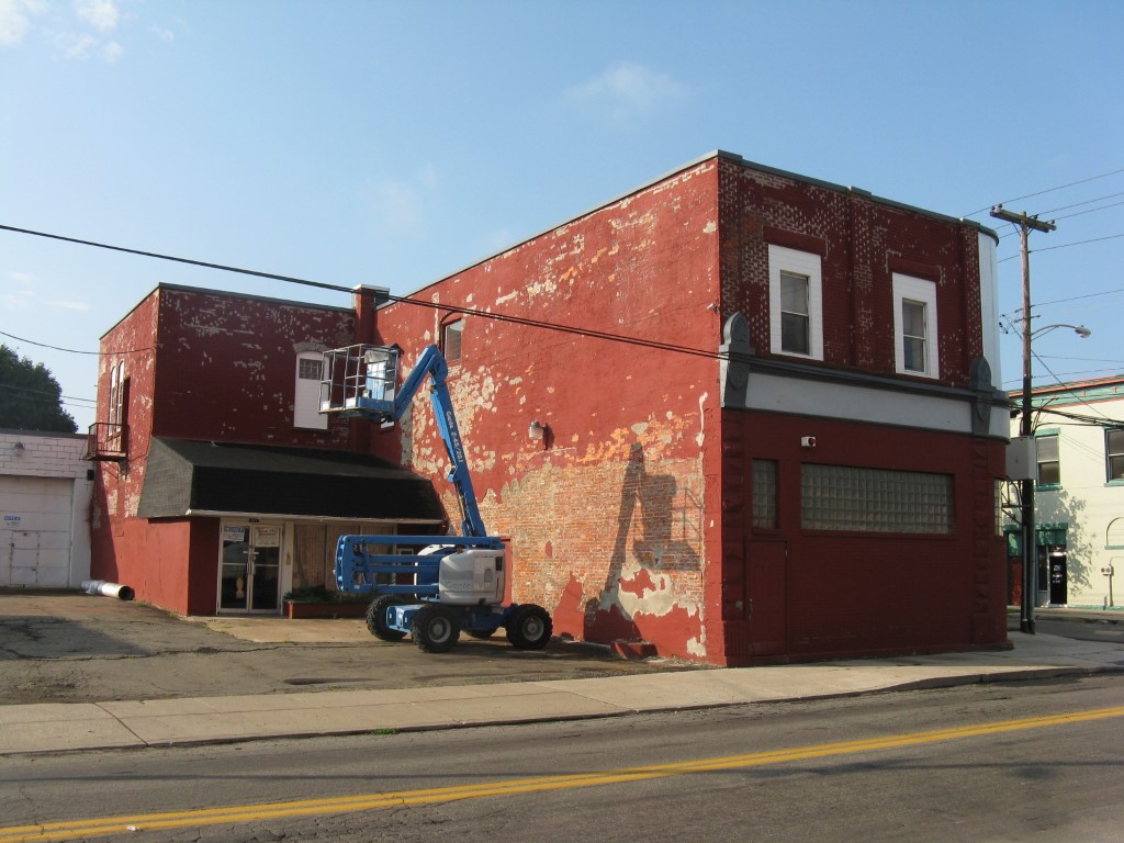
Address: 363 W 18 ST
Parcel: 19060009023600
Parcel Profile
Address
363 | W | 18 | ST
Street Status
PAVED | SIDEWALK
School District
CITY OF ERIE SCHOOL
Acreage
0.2447
Classification
C
Land Use Code
WAREHOUSES
Legal Description
363 W 18 ET 1805 CHEST 82X130
Square Feet
9302
Topo
LEVEL
Utility
ALL PUBLIC
Zoning
Please contact your municipal zoning officer
Deed Book
1284
Deed Page
1710
2026 Tax Values
Land Value / Taxable
26,700 / 26,700.00
Building Value / Taxable
38,300 / 38,300.00
Total Value / Taxable
65,000 / 65,000.00
Clean & Green
Inactive
Homestead Status
Inactive
Farmstead Status
Inactive
Lerta Amount
0
Lerta Expiration Year
0
Commercial Data
Card 1
WAREHOUSE
Business Living Area - 9302
Year Built - 1920
Improvement Name - WAREHOUSE
Value - 105740
Other Buildings & Yards
No OBY Data Found
Sales History
Sale Date
Type
Price
Book / Page
Other Info
11/4/2005
LAND & BUILDING
68000
1284 / 1710
WARRANTY/SURVIVORSHIP DEED
7/27/2005
LAND & BUILDING
10500
1255 / 0634
DEED
12/31/1991
0
0189 / 2363
Parcel Sketches
Commercial Card 1
A
MAIN
1590 square feet
B
MAIN
1590 square feet
C
MAIN
1590 square feet
D
MAIN
1400 square feet
E
MAIN
1400 square feet
F
MAIN
280 square feet
G
MAIN
3042 square feet
Parcel Images
Please note:
this tab is for informational purposes only and may not show all delinquencies, see the Taxes tab for more accurate delinquent taxes due.