Elected Officials
Courts
Departments
Initiatives
Open Government
About
Login / Register
Home
/
Property & Tax Records
/
Property Records
/
Property & Tax Search
/
Parcel Profile
/
Print View
Search for Another Parcel
Parcel Profile
Historical Card
Sketches
Photos
Tax Map
Taxes
Print View
Print This Page
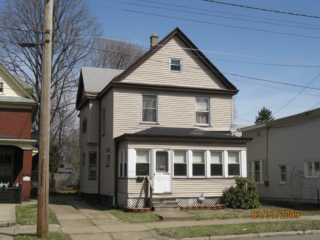
Address: 2115 CHESTNUT ST
Parcel: 19060010012900
Parcel Profile
Address
2115 | CHESTNUT | ST
Street Status
PAVED | SIDEWALK
School District
CITY OF ERIE SCHOOL
Acreage
0.0783
Classification
R
Land Use Code
SINGLE FAMILY
Legal Description
2115 CHESTNUT ST 4X80 30X103
Square Feet
1812
Topo
LEVEL
Utility
ALL PUBLIC
Zoning
Please contact your municipal zoning officer
Deed Book
2025
Deed Page
011964
2026 Tax Values
Land Value / Taxable
10,300 / 10,300.00
Building Value / Taxable
57,060 / 57,060.00
Total Value / Taxable
67,360 / 67,360.00
Clean & Green
Inactive
Homestead Status
Active
Farmstead Status
Inactive
Lerta Amount
0
Lerta Expiration Year
0
Residential Data
Card 1
Style
OLD STYLE
Basement
FULL
Year Built
1900
Exterior Wall
ALUMINUM/VINYL
Total Living Area
1812
Full Baths
1
Half Baths
0
Fuel Type
GAS
Heating
CENTRAL
Heating System
FORCED AIR
Stories
2.0
Total Bedrooms
3
Total Family Rooms
0
Total Rooms
7
Fireplaces
0
Other Buildings & Yards
No OBY Data Found
Sales History
Sale Date
Type
Price
Book / Page
Other Info
7/21/2025
LAND & BUILDING
121000
2025 / 011964
SPECIAL WARRANTY DEED
7/26/2024
LAND & BUILDING
65000
2024 / 011589
SPECIAL WARRANTY DEED
2/5/2015
LAND & BUILDING
22000
2015 / 002186
DEED
5/7/2014
LAND & BUILDING
0
2014 / 008637
QUIT CLAIM DEED
8/14/2013
LAND & BUILDING
1920
2013 / 021382
SHERIFF'S DED
7/31/2007
LAND & BUILDING
66000
1435 / 1607
WARRANTY/SURVIVORSHIP DEED
6/23/2003
LAND & BUILDING
0
1026 / 0449
QUIT CLAIM DEED
6/2/1992
0
0215 / 0008
Parcel Sketches
Residential Card 1
A
MAIN
788 square feet
B
EFP ENCL FRAME PORCH
120 square feet
C
FRBAY FRAME BAY FRBAY FRAME BAY
28 square feet
D
1S FR ONE STORY FRAME
180 square feet
Parcel Images
Please note:
this tab is for informational purposes only and may not show all delinquencies, see the Taxes tab for more accurate delinquent taxes due.