Elected Officials
Courts
Departments
Initiatives
Open Government
About
Login / Register
Home
/
Property & Tax Records
/
Property Records
/
Property & Tax Search
/
Parcel Profile
/
Print View
Search for Another Parcel
Parcel Profile
Historical Card
Sketches
Photos
Tax Map
Taxes
Print View
Print This Page
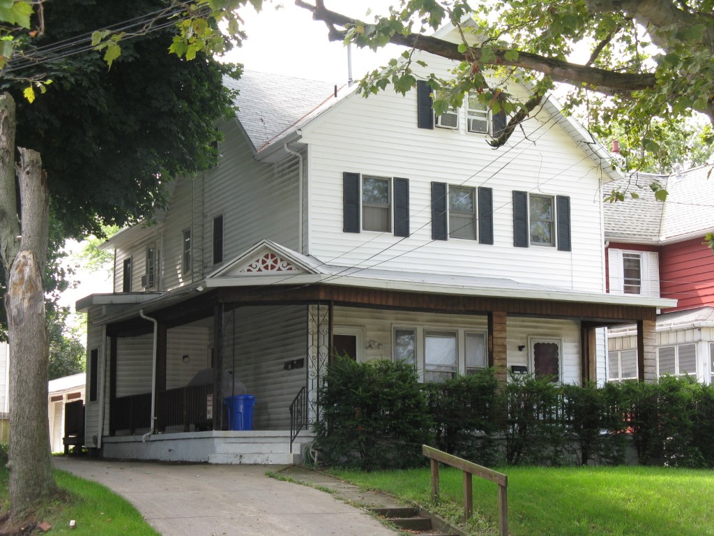
Address: 607 BROWN AVE
Parcel: 19060017020400
Parcel Profile
Address
607 | BROWN | AVE
Street Status
PAVED
School District
CITY OF ERIE SCHOOL
Acreage
0.1346
Classification
A
Land Use Code
APARTMENTS 4 - 19 UNITS
Legal Description
607 BROWN AVE 45 X IRR
Square Feet
4120
Topo
LEVEL
Utility
ALL PUBLIC
Zoning
Please contact your municipal zoning officer
Deed Book
2023
Deed Page
0021434
2026 Tax Values
Land Value / Taxable
14,700 / 14,700.00
Building Value / Taxable
73,600 / 73,600.00
Total Value / Taxable
88,300 / 88,300.00
Clean & Green
Inactive
Homestead Status
Inactive
Farmstead Status
Inactive
Lerta Amount
0
Lerta Expiration Year
0
Commercial Data
Card 1
RESIDENTIAL 4 FAMILY
Business Living Area - 4120
Year Built - 1868
Improvement Name - APARTMENTS
Value - 73580
Other Buildings & Yards
No OBY Data Found
Sales History
Sale Date
Type
Price
Book / Page
Other Info
12/11/2023
LAND & BUILDING
145000
2023 / 0021434
SPECIAL WARRANTY DEED
9/4/2009
LAND & BUILDING
86000
1588 / 0634
DEED
5/5/1993
0
0267 / 0023
Parcel Sketches
Commercial Card 1
A
MAIN
1182 square feet
B
MAIN
1282 square feet
C
MAIN
1104 square feet
D
MAIN
552 square feet
Parcel Images
Please note:
this tab is for informational purposes only and may not show all delinquencies, see the Taxes tab for more accurate delinquent taxes due.