Elected Officials
Courts
Departments
Initiatives
Open Government
About
Login / Register
Home
/
Property & Tax Records
/
Property Records
/
Property & Tax Search
/
Parcel Profile
/
Print View
Search for Another Parcel
Parcel Profile
Historical Card
Sketches
Photos
Tax Map
Taxes
Print View
Print This Page
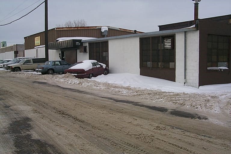
Address: 1014 W 19 ST
Parcel: 19060029022200
Parcel Profile
Address
1014 | W | 19 | ST
Street Status
PAVED
School District
CITY OF ERIE SCHOOL
Acreage
0.5831
Classification
E
Land Use Code
EXEMPT HOUSING/REDEVELOPMENT AUTHORITIES
Legal Description
W 19 ST NS BET CASCADE & RASPB
Square Feet
14619
Topo
LEVEL
Utility
ALL PUBLIC
Zoning
Please contact your municipal zoning officer
Deed Book
2025
Deed Page
013632
2026 Tax Values
Land Value / Taxable
43,500 / 43,500.00
Building Value / Taxable
62,800 / 62,800.00
Total Value / Taxable
106,300 / 106,300.00
Clean & Green
Inactive
Homestead Status
Inactive
Farmstead Status
Inactive
Lerta Amount
0
Lerta Expiration Year
0
Commercial Data
Card 1
WAREHOUSE
Business Living Area - 14619
Year Built - 1901
Improvement Name - AMERICAN & FOREIGN AUTO RECYCL
Value - 72770
Other Buildings & Yards
No OBY Data Found
Sales History
Sale Date
Type
Price
Book / Page
Other Info
8/12/2025
LAND & BUILDING
33000
2025 / 013632
QUIT CLAIM DEED
11/25/2014
LAND & BUILDING
50000
2014 / 025583
DEED
9/9/1993
0
0290 / 1643
Parcel Sketches
Commercial Card 1
A
MAIN
2400 square feet
B
MAIN
4155 square feet
C
MAIN
4032 square feet
D
MAIN
4032 square feet
Parcel Images
Please note:
this tab is for informational purposes only and may not show all delinquencies, see the Taxes tab for more accurate delinquent taxes due.