Elected Officials
Courts
Departments
Initiatives
Open Government
About
Login / Register
Home
/
Property & Tax Records
/
Property Records
/
Property & Tax Search
/
Parcel Profile
/
Print View
Search for Another Parcel
Parcel Profile
Historical Card
Sketches
Photos
Tax Map
Taxes
Print View
Print This Page
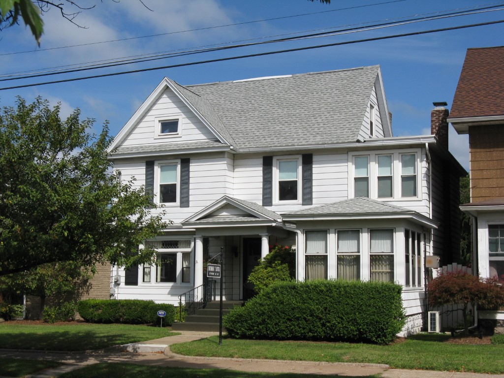
Address: 1026 W 26 ST
Parcel: 19060032013300
Parcel Profile
Address
1026 | W | 26 | ST
Street Status
PAVED
School District
CITY OF ERIE SCHOOL
Acreage
0.2101
Classification
C
Land Use Code
OFFICE BLDGS/LABS/LIBRARIES
Legal Description
1026 W 26 ST 61X150
Square Feet
4527
Topo
LEVEL
Utility
ALL PUBLIC
Zoning
Please contact your municipal zoning officer
Deed Book
1484
Deed Page
2131
2026 Tax Values
Land Value / Taxable
27,500 / 27,500.00
Building Value / Taxable
56,200 / 56,200.00
Total Value / Taxable
83,700 / 83,700.00
Clean & Green
Inactive
Homestead Status
Inactive
Farmstead Status
Inactive
Lerta Amount
0
Lerta Expiration Year
0
Commercial Data
Card 1
MIXED RESIDENTIAL/COMMERCIAL
Business Living Area - 4527
Year Built - 1908
Improvement Name - LAW OFFICE AND RESIDENCE
Value - 52000
Other Buildings & Yards
Description
Built
Width
Length
Area
FRAME OR CB DETACHED GARAGE
1920
15
32
480
Sales History
Sale Date
Type
Price
Book / Page
Other Info
3/31/2008
LAND & BUILDING
50000
1484 / 2131
FIDUCIARY DEED
3/12/1986
0
1621 / 0271
Parcel Sketches
Commercial Card 1
A
MAIN
429 square feet
B
MAIN
1138 square feet
C
MAIN
1138 square feet
D
MAIN
1078 square feet
E
MAIN
248 square feet
F
MAIN
248 square feet
G
MAIN
248 square feet
Parcel Images
Please note:
this tab is for informational purposes only and may not show all delinquencies, see the Taxes tab for more accurate delinquent taxes due.