Elected Officials
Courts
Departments
Initiatives
Open Government
About
Login / Register
Home
/
Property & Tax Records
/
Property Records
/
Property & Tax Search
/
Parcel Profile
/
Print View
Search for Another Parcel
Parcel Profile
Historical Card
Sketches
Photos
Tax Map
Taxes
Print View
Print This Page
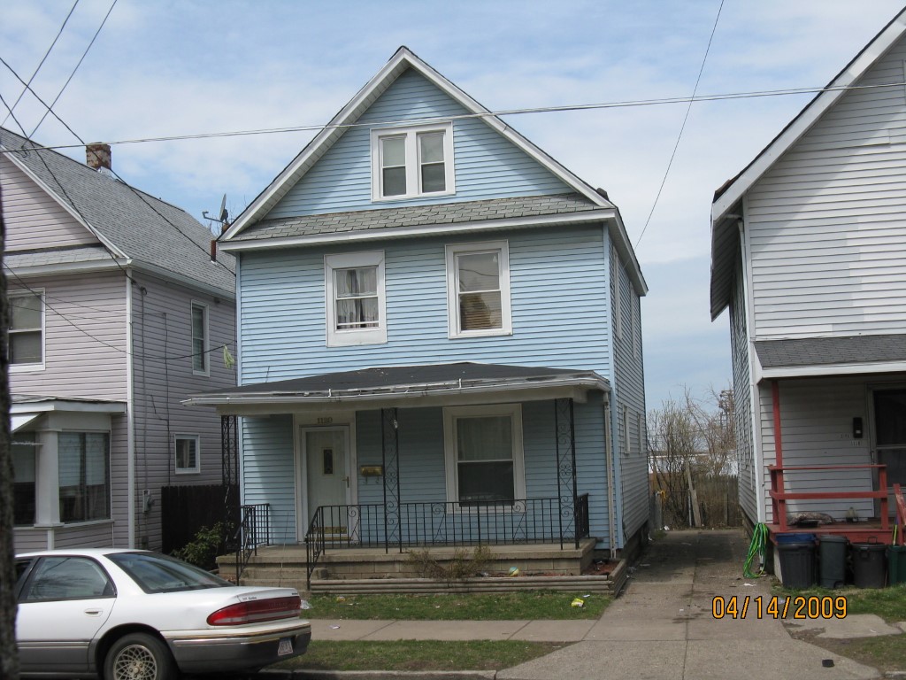
Address: 1120 W 20 ST
Parcel: 19060033012000
Parcel Profile
Address
1120 | W | 20 | ST
Street Status
PAVED
School District
CITY OF ERIE SCHOOL
Acreage
0.0861
Classification
R
Land Use Code
SINGLE FAMILY
Legal Description
1120 W 20 ST 30X125
Square Feet
1320
Topo
LEVEL
Utility
ALL PUBLIC
Zoning
Please contact your municipal zoning officer
Deed Book
0968
Deed Page
1853
2026 Tax Values
Land Value / Taxable
10,600 / 10,600.00
Building Value / Taxable
41,970 / 41,970.00
Total Value / Taxable
52,570 / 52,570.00
Clean & Green
Inactive
Homestead Status
Inactive
Farmstead Status
Inactive
Lerta Amount
0
Lerta Expiration Year
0
Residential Data
Card 1
Style
OLD STYLE
Basement
FULL
Year Built
1918
Exterior Wall
ALUMINUM/VINYL
Total Living Area
1320
Full Baths
1
Half Baths
0
Fuel Type
GAS
Heating
CENTRAL
Heating System
FORCED AIR
Stories
2.0
Total Bedrooms
3
Total Family Rooms
0
Total Rooms
7
Fireplaces
0
Other Buildings & Yards
Description
Built
Width
Length
Area
FRAME UTILITY SHED
1980
8
12
96
Sales History
Sale Date
Type
Price
Book / Page
Other Info
1/21/2003
LAND & BUILDING
42900
0968 / 1853
11/19/1982
0
1477 / 0249
Parcel Sketches
Residential Card 1
A
MAIN
660 square feet
B
EFP ENCL FRAME PORCH
36 square feet
C
OFP OPEN FRAME PORCH
140 square feet
Parcel Images
Please note:
this tab is for informational purposes only and may not show all delinquencies, see the Taxes tab for more accurate delinquent taxes due.