Elected Officials
Courts
Departments
Initiatives
Open Government
About
Login / Register
Home
/
Property & Tax Records
/
Property Records
/
Property & Tax Search
/
Parcel Profile
/
Print View
Search for Another Parcel
Parcel Profile
Historical Card
Sketches
Photos
Tax Map
Taxes
Print View
Print This Page
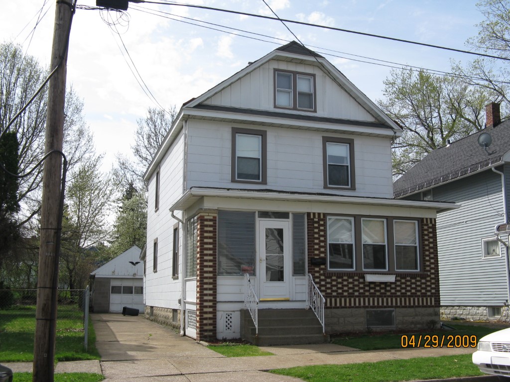
Address: 1043 W 31 ST
Parcel: 19060038011700
Parcel Profile
Address
1043 | W | 31 | ST
Street Status
PAVED | SIDEWALK
School District
CITY OF ERIE SCHOOL
Acreage
0.1088
Classification
R
Land Use Code
SINGLE FAMILY
Legal Description
1043 W 31 ST 35.1X135
Square Feet
1424
Topo
LEVEL
Utility
ALL PUBLIC
Zoning
Please contact your municipal zoning officer
Deed Book
0883
Deed Page
0326
2026 Tax Values
Land Value / Taxable
16,900 / 16,900.00
Building Value / Taxable
63,710 / 63,710.00
Total Value / Taxable
80,610 / 80,610.00
Clean & Green
Inactive
Homestead Status
Active
Farmstead Status
Inactive
Lerta Amount
0
Lerta Expiration Year
0
Residential Data
Card 1
Style
OLD STYLE
Basement
FULL
Year Built
1927
Exterior Wall
COMPOSITION
Total Living Area
1424
Full Baths
1
Half Baths
1
Fuel Type
GAS
Heating
CENTRAL
Heating System
FORCED AIR
Stories
2.0
Total Bedrooms
4
Total Family Rooms
0
Total Rooms
6
Fireplaces
0
Other Buildings & Yards
No OBY Data Found
Sales History
Sale Date
Type
Price
Book / Page
Other Info
5/23/2002
LAND & BUILDING
66000
0883 / 0326
12/3/2001
LAND & BUILDING
0
830 / 2261
Parcel Sketches
Residential Card 1
A
MAIN
660 square feet
B
EFP ENCL FRAME PORCH
35 square feet
C
UNFIN BSMT BASEMENT UNFINISHED 1SMAS MASONRY
104 square feet
D
EFP ENCL FRAME PORCH
72 square feet
E
MA STOOP/TERR MAS STOOP
20 square feet
Parcel Images
Please note:
this tab is for informational purposes only and may not show all delinquencies, see the Taxes tab for more accurate delinquent taxes due.