Elected Officials
Courts
Departments
Initiatives
Open Government
About
Login / Register
Home
/
Property & Tax Records
/
Property Records
/
Property & Tax Search
/
Parcel Profile
/
Print View
Search for Another Parcel
Parcel Profile
Historical Card
Sketches
Photos
Tax Map
Taxes
Print View
Print This Page
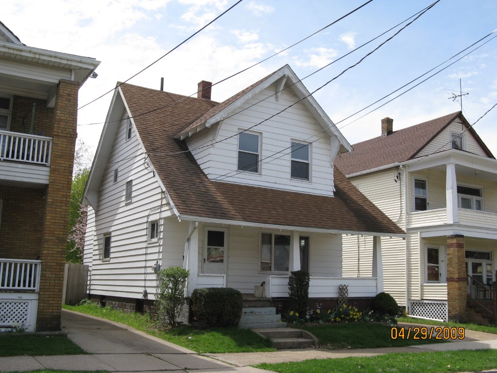
Address: 1039 W 30 ST
Parcel: 19060038021800
Parcel Profile
Address
1039 | W | 30 | ST
Street Status
PAVED | SIDEWALK
School District
CITY OF ERIE SCHOOL
Acreage
0.1086
Classification
R
Land Use Code
SINGLE FAMILY
Legal Description
1039 W 30 ST 35.04 X 135
Square Feet
1266
Topo
LEVEL
Utility
ALL PUBLIC
Zoning
Please contact your municipal zoning officer
Deed Book
2015
Deed Page
027469
2026 Tax Values
Land Value / Taxable
16,900 / 16,900.00
Building Value / Taxable
55,000 / 55,000.00
Total Value / Taxable
71,900 / 71,900.00
Clean & Green
Inactive
Homestead Status
Inactive
Farmstead Status
Inactive
Lerta Amount
0
Lerta Expiration Year
0
Residential Data
Card 1
Style
OLD STYLE
Basement
FULL
Year Built
1924
Exterior Wall
ALUMINUM/VINYL
Total Living Area
1266
Full Baths
1
Half Baths
0
Fuel Type
GAS
Heating
CENTRAL
Heating System
FORCED AIR
Stories
2.0
Total Bedrooms
3
Total Family Rooms
0
Total Rooms
8
Fireplaces
0
Other Buildings & Yards
Description
Built
Width
Length
Area
FRAME OR CB DETACHED GARAGE
1924
14
18
252
Sales History
Sale Date
Type
Price
Book / Page
Other Info
12/16/2015
LAND & BUILDING
64000
2015 / 027469
SPECIAL WARRANTY DEED
9/11/1992
0
0229 / 2114
Parcel Sketches
Residential Card 1
A
MAIN
352 square feet
B
1S FR ONE STORY FRAME
100 square feet
C
OFP OPEN FRAME PORCH
100 square feet
D
UNFIN BSMT BASEMENT UNFINISHED 1S FR ONE STORY FRAME 1S FR ONE STORY FRAME
220 square feet
E
OFP OPEN FRAME PORCH AT FN ATTIC-FINISHED
56 square feet
F
OFP OPEN FRAME PORCH
98 square feet
G
MA STOOP/TERR MAS STOOP
20 square feet
Parcel Images
Please note:
this tab is for informational purposes only and may not show all delinquencies, see the Taxes tab for more accurate delinquent taxes due.