Elected Officials
Courts
Departments
Initiatives
Open Government
About
Login / Register
Home
/
Property & Tax Records
/
Property Records
/
Property & Tax Search
/
Parcel Profile
/
Print View
Search for Another Parcel
Parcel Profile
Historical Card
Sketches
Photos
Tax Map
Taxes
Print View
Print This Page
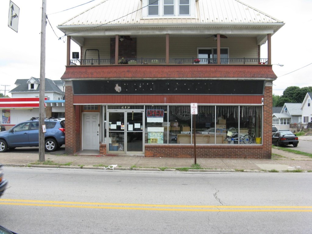
Address: 613 W 26 ST
Parcel: 19060043012100
Parcel Profile
Address
613 | W | 26 | ST
Street Status
PAVED | SIDEWALK
School District
CITY OF ERIE SCHOOL
Acreage
0.0964
Classification
C
Land Use Code
RESTAURANTS, STORES (RETAIL)
Legal Description
613 W 26 ST 35X120
Square Feet
6061
Topo
LEVEL
Utility
ALL PUBLIC
Zoning
Please contact your municipal zoning officer
Deed Book
1452
Deed Page
1828
2026 Tax Values
Land Value / Taxable
12,600 / 12,600.00
Building Value / Taxable
112,500 / 112,500.00
Total Value / Taxable
125,100 / 125,100.00
Clean & Green
Inactive
Homestead Status
Active
Farmstead Status
Inactive
Lerta Amount
0
Lerta Expiration Year
0
Commercial Data
Card 1
MIXED RES/COMM
Business Living Area - 6061
Year Built - 1911
Improvement Name - GRAHAM USED RECORDS AND TAPES
Value - 118410
Other Buildings & Yards
No OBY Data Found
Sales History
Sale Date
Type
Price
Book / Page
Other Info
10/10/2007
LAND & BUILDING
0
1452 / 1828
QUIT CLAIM DEED
10/5/1999
LAND & BUILDING
75000
666 / 439
Parcel Sketches
Commercial Card 1
A
MAIN
3536 square feet
B
MAIN
2253 square feet
C
MAIN
2040 square feet
D
MAIN
1768 square feet
E
MAIN
1768 square feet
F
MAIN
1768 square feet
Parcel Images
Please note:
this tab is for informational purposes only and may not show all delinquencies, see the Taxes tab for more accurate delinquent taxes due.