Elected Officials
Courts
Departments
Initiatives
Open Government
About
Login / Register
Home
/
Property & Tax Records
/
Property Records
/
Property & Tax Search
/
Parcel Profile
/
Print View
Search for Another Parcel
Parcel Profile
Historical Card
Sketches
Photos
Tax Map
Taxes
Print View
Print This Page
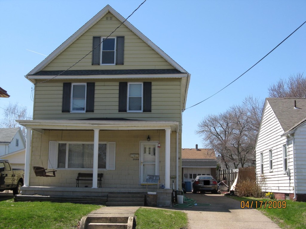
Address: 2666 CHESTNUT ST
Parcel: 19060048010600
Parcel Profile
Address
2666 | CHESTNUT | ST
Street Status
PAVED | SIDEWALK
School District
CITY OF ERIE SCHOOL
Acreage
0.1377
Classification
R
Land Use Code
SINGLE FAMILY
Legal Description
2666 CHESTNUT ST 40X150
Square Feet
1784
Topo
LEVEL
Utility
ALL PUBLIC
Zoning
Please contact your municipal zoning officer
Deed Book
0796
Deed Page
0260
2026 Tax Values
Land Value / Taxable
11,300 / 11,300.00
Building Value / Taxable
65,500 / 65,500.00
Total Value / Taxable
76,800 / 76,800.00
Clean & Green
Inactive
Homestead Status
Active
Farmstead Status
Inactive
Lerta Amount
0
Lerta Expiration Year
0
Residential Data
Card 1
Style
OLD STYLE
Basement
FULL
Year Built
1914
Exterior Wall
ALUMINUM/VINYL
Total Living Area
1784
Full Baths
1
Half Baths
1
Fuel Type
GAS
Heating
CENTRAL
Heating System
FORCED AIR
Stories
2.0
Total Bedrooms
3
Total Family Rooms
0
Total Rooms
6
Fireplaces
1
Other Buildings & Yards
Description
Built
Width
Length
Area
BRICK OR STONE DETACHED GAR.
1940
18
24
432
Sales History
Sale Date
Type
Price
Book / Page
Other Info
7/27/2001
LAND & BUILDING
73000
0796 / 0260
7/27/2001
LAND & BUILDING
73000
0796 / 0260
Parcel Sketches
Residential Card 1
A
MAIN
672 square feet
B
1S FR ONE STORY FRAME
220 square feet
C
1SMAS MASONRY
220 square feet
D
OFP OPEN FRAME PORCH
160 square feet
Parcel Images
Please note:
this tab is for informational purposes only and may not show all delinquencies, see the Taxes tab for more accurate delinquent taxes due.