Elected Officials
Courts
Departments
Initiatives
Open Government
About
Login / Register
Home
/
Property & Tax Records
/
Property Records
/
Property & Tax Search
/
Parcel Profile
/
Print View
Search for Another Parcel
Parcel Profile
Historical Card
Sketches
Photos
Tax Map
Taxes
Print View
Print This Page
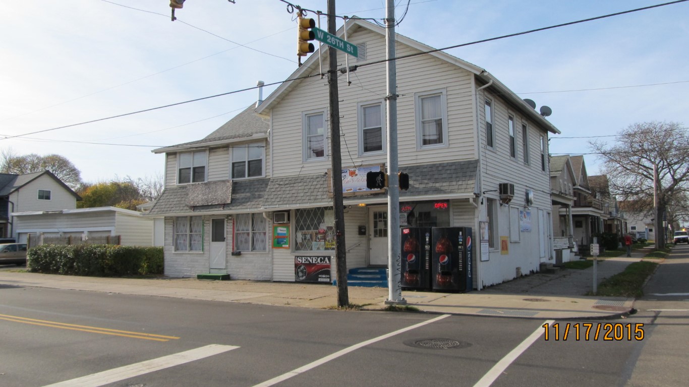
Address: 2602 MYRTLE ST
Parcel: 19060050012000
Parcel Profile
Address
2602 | MYRTLE | ST
Street Status
PAVED
School District
CITY OF ERIE SCHOOL
Acreage
0.0999
Classification
C
Land Use Code
RESTAURANTS, STORES (RETAIL)
Legal Description
2602 MYRTLE ST 37.25 X 116
Square Feet
3394
Topo
LEVEL
Utility
ALL PUBLIC
Zoning
Please contact your municipal zoning officer
Deed Book
1524
Deed Page
1904
2026 Tax Values
Land Value / Taxable
13,100 / 13,100.00
Building Value / Taxable
60,500 / 60,500.00
Total Value / Taxable
73,600 / 73,600.00
Clean & Green
Inactive
Homestead Status
Inactive
Farmstead Status
Inactive
Lerta Amount
0.00
Lerta Expiration Year
2016
Commercial Data
Card 1
MIXED RES/COMM
Business Living Area - 3394
Year Built - 1936
Improvement Name - GRAB N GO
Value - 55190
Other Buildings & Yards
Description
Built
Width
Length
Area
FRAME OR CB DETACHED GARAGE
1936
19
36
684
Sales History
Sale Date
Type
Price
Book / Page
Other Info
10/8/2008
LAND & BUILDING
81000
1524 / 1904
DEED
7/7/2006
LAND & BUILDING
0
1343 / 0151
WARRANTY/SURVIVORSHIP DEED
11/24/1993
0
0305 / 1628
Parcel Sketches
Commercial Card 1
A
MAIN
460 square feet
B
MAIN
442 square feet
C
MAIN
1476 square feet
D
MAIN
1476 square feet
Parcel Images
Please note:
this tab is for informational purposes only and may not show all delinquencies, see the Taxes tab for more accurate delinquent taxes due.