Elected Officials
Courts
Departments
Initiatives
Open Government
About
Login / Register
Home
/
Property & Tax Records
/
Property Records
/
Property & Tax Search
/
Parcel Profile
/
Print View
Search for Another Parcel
Parcel Profile
Historical Card
Sketches
Photos
Tax Map
Taxes
Print View
Print This Page
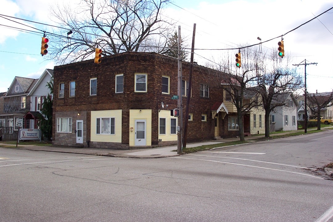
Address: 2603 CHESTNUT ST
Parcel: 19060050022400
Parcel Profile
Address
2603 | CHESTNUT | ST
Street Status
PAVED
School District
CITY OF ERIE SCHOOL
Acreage
0.0551
Classification
A
Land Use Code
APARTMENTS 4 - 19 UNITS
Legal Description
2603 CHESTNUT ST 40 X 60
Square Feet
4301
Topo
LEVEL
Utility
ALL PUBLIC
Zoning
Please contact your municipal zoning officer
Deed Book
2021
Deed Page
009293
2026 Tax Values
Land Value / Taxable
7,200 / 7,200.00
Building Value / Taxable
74,200 / 74,200.00
Total Value / Taxable
81,400 / 81,400.00
Clean & Green
Inactive
Homestead Status
Inactive
Farmstead Status
Inactive
Lerta Amount
0
Lerta Expiration Year
0
Commercial Data
Card 1
MIXED RES/COMM
Business Living Area - 4301
Year Built - 1922
Improvement Name - APARTMENTS
Value - 96230
Other Buildings & Yards
No OBY Data Found
Sales History
Sale Date
Type
Price
Book / Page
Other Info
4/16/2021
LAND & BUILDING
72500
2021 / 009293
SPECIAL WARRANTY DEED
2/4/2019
LAND & BUILDING
81250
2019 / 001967
SPECIAL WARRANTY DEED
4/8/2004
LAND & BUILDING
0
1123 / 0016
QUIT CLAIM DEED
4/29/1985
0
1577 / 0330
Parcel Sketches
Commercial Card 1
A
MAIN
2128 square feet
B
MAIN
2128 square feet
C
MAIN
2173 square feet
Parcel Images
Please note:
this tab is for informational purposes only and may not show all delinquencies, see the Taxes tab for more accurate delinquent taxes due.