Elected Officials
Courts
Departments
Initiatives
Open Government
About
Login / Register
Home
/
Property & Tax Records
/
Property Records
/
Property & Tax Search
/
Parcel Profile
/
Print View
Search for Another Parcel
Parcel Profile
Historical Card
Sketches
Photos
Tax Map
Taxes
Print View
Print This Page
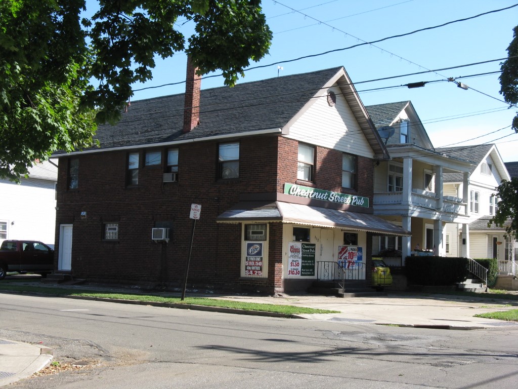
Address: 362 W 31 ST
Parcel: 19060051023200
Parcel Profile
Address
362 | W | 31 | ST
Street Status
PAVED
School District
CITY OF ERIE SCHOOL
Acreage
0.0519
Classification
C
Land Use Code
RESTAURANTS, STORES (RETAIL)
Legal Description
362 W 31 ST 30 X IRR
Square Feet
1672
Topo
LEVEL
Utility
ALL PUBLIC
Zoning
Please contact your municipal zoning officer
Deed Book
2022
Deed Page
026785
2026 Tax Values
Land Value / Taxable
11,300 / 11,300.00
Building Value / Taxable
67,200 / 67,200.00
Total Value / Taxable
78,500 / 78,500.00
Clean & Green
Inactive
Homestead Status
Inactive
Farmstead Status
Inactive
Lerta Amount
0
Lerta Expiration Year
0
Commercial Data
Card 1
MIXED RES/COMM
Business Living Area - 1672
Year Built - 1919
Improvement Name - CHESTNUT STREET PUB
Value - 65220
Other Buildings & Yards
No OBY Data Found
Sales History
Sale Date
Type
Price
Book / Page
Other Info
12/27/2022
LAND & BUILDING
70000
2022 / 026785
DEED
2/4/2010
LAND & BUILDING
85000
2010 / 002617
DEED
4/20/2004
LAND & BUILDING
125000
1126 / 1905
WARRANTY/SURVIVORSHIP DEED
5/7/1990
0
0121 / 0628
Parcel Sketches
Commercial Card 1
A
MAIN
836 square feet
B
MAIN
836 square feet
C
MAIN
836 square feet
Parcel Images
Please note:
this tab is for informational purposes only and may not show all delinquencies, see the Taxes tab for more accurate delinquent taxes due.