Elected Officials
Courts
Departments
Initiatives
Open Government
About
Login / Register
Home
/
Property & Tax Records
/
Property Records
/
Property & Tax Search
/
Parcel Profile
/
Print View
Search for Another Parcel
Parcel Profile
Historical Card
Sketches
Photos
Tax Map
Taxes
Print View
Print This Page
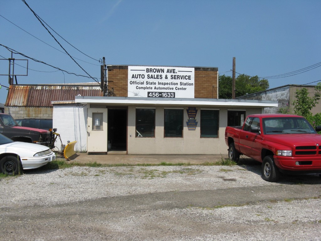
Address: 1302 W 26 ST
Parcel: 19062004010000
Parcel Profile
Address
1302 | W | 26 | ST
Street Status
PAVED | SIDEWALK
School District
CITY OF ERIE SCHOOL
Acreage
0.4063
Classification
C
Land Use Code
RESTAURANTS, STORES (RETAIL)
Legal Description
NS W 26TH ST AT BROWN AVE
Square Feet
4779
Topo
LEVEL
Utility
ALL PUBLIC
Zoning
Please contact your municipal zoning officer
Deed Book
2020
Deed Page
027905
2026 Tax Values
Land Value / Taxable
70,800 / 70,800.00
Building Value / Taxable
56,600 / 56,600.00
Total Value / Taxable
127,400 / 127,400.00
Clean & Green
Inactive
Homestead Status
Inactive
Farmstead Status
Inactive
Lerta Amount
0
Lerta Expiration Year
0
Commercial Data
Card 1
AUTO SERVICE GARAGE
Business Living Area - 4779
Year Built - 1967
Improvement Name - BROWN AVENUE AUTO
Value - 56630
Other Buildings & Yards
No OBY Data Found
Sales History
Sale Date
Type
Price
Book / Page
Other Info
12/28/2020
LAND & BUILDING
123700
2020 / 027905
FIDUCIARY DEED
6/13/2007
LAND & BUILDING
0
1422 / 2363
WARRANTY/SURVIVORSHIP DEED
12/9/2005
LAND & BUILDING
0
1293 / 0333
WARRANTY/SURVIVORSHIP DEED
12/18/1971
0
1035 / 0354
Parcel Sketches
Commercial Card 1
A
MAIN
4779 square feet
Parcel Images
Please note:
this tab is for informational purposes only and may not show all delinquencies, see the Taxes tab for more accurate delinquent taxes due.