Elected Officials
Courts
Departments
Initiatives
Open Government
About
Login / Register
Home
/
Property & Tax Records
/
Property Records
/
Property & Tax Search
/
Parcel Profile
/
Print View
Search for Another Parcel
Parcel Profile
Historical Card
Sketches
Photos
Tax Map
Taxes
Print View
Print This Page
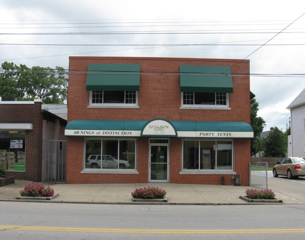
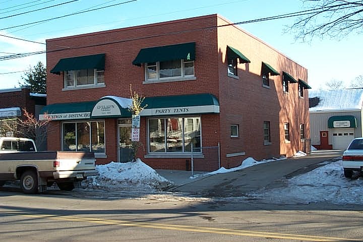
Address: 1139 W 26 ST
Parcel: 19062018031400
Parcel Profile
Address
1139 | W | 26 | ST
Street Status
PAVED | SIDEWALK
School District
CITY OF ERIE SCHOOL
Acreage
0.2149
Classification
C
Land Use Code
RESTAURANTS, STORES (RETAIL)
Legal Description
1139 W 26 ST 45 X 160
Square Feet
10760
Topo
LEVEL
Utility
ALL PUBLIC
Zoning
Please contact your municipal zoning officer
Deed Book
2017
Deed Page
024929
2026 Tax Values
Land Value / Taxable
37,400 / 37,400.00
Building Value / Taxable
185,800 / 185,800.00
Total Value / Taxable
223,200 / 223,200.00
Clean & Green
Inactive
Homestead Status
Inactive
Farmstead Status
Inactive
Lerta Amount
0
Lerta Expiration Year
0
Commercial Data
Card 1
WAREHOUSE
Business Living Area - 6272
Year Built - 1980
Improvement Name - GUY E ALLEN AND SONS AWNING
Value - 38070
Card 2
MIXED RESIDENTIAL/COMMERCIAL
Business Living Area - 4488
Year Built - 1956
Improvement Name - GUY E ALLEN AND SON AWNINGS
Value - 77970
Other Buildings & Yards
No OBY Data Found
Sales History
Sale Date
Type
Price
Book / Page
Other Info
11/13/2017
LAND & BUILDING
240000
2017 / 024929
SPECIAL WARRANTY DEED
6/28/1992
0
0218 / 2293
Parcel Sketches
Commercial Card 1
A
MAIN
3136 square feet
B
MAIN
3136 square feet
Commercial Card 2
A
MAIN
1020 square feet
B
MAIN
1020 square feet
C
MAIN
1020 square feet
D
MAIN
1224 square feet
E
MAIN
1224 square feet
F
MAIN
1224 square feet
Parcel Images
Please note:
this tab is for informational purposes only and may not show all delinquencies, see the Taxes tab for more accurate delinquent taxes due.