Elected Officials
Courts
Departments
Initiatives
Open Government
About
Login / Register
Home
/
Property & Tax Records
/
Property Records
/
Property & Tax Search
/
Parcel Profile
/
Print View
Search for Another Parcel
Parcel Profile
Historical Card
Sketches
Photos
Tax Map
Taxes
Print View
Print This Page
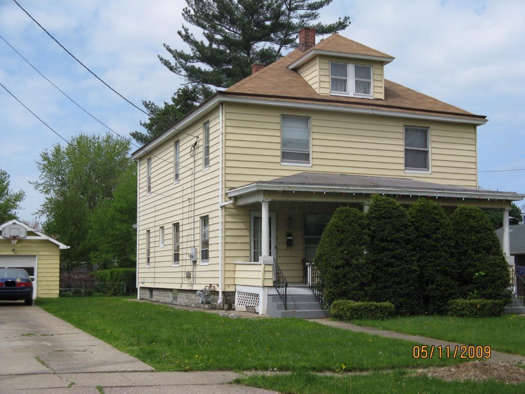
Address: 2910 12 ELLSWORTH 100 X 147.26
Parcel: 19062037010500
Parcel Profile
Address
2910 | 12 | ELLSWORTH 100 X 147.26
Street Status
PAVED
School District
CITY OF ERIE SCHOOL
Acreage
0.3375
Classification
R
Land Use Code
TWO FAMILY
Legal Description
2910 12 ELLSWORTH 100 X 147.26
Square Feet
2400
Topo
LEVEL
Utility
ALL PUBLIC
Zoning
Please contact your municipal zoning officer
Deed Book
2019
Deed Page
002357
2026 Tax Values
Land Value / Taxable
20,600 / 20,600.00
Building Value / Taxable
86,790 / 86,790.00
Total Value / Taxable
107,390 / 107,390.00
Clean & Green
Inactive
Homestead Status
Inactive
Farmstead Status
Inactive
Lerta Amount
0
Lerta Expiration Year
0
Residential Data
Card 1
Style
TWIN
Basement
FULL
Year Built
1914
Exterior Wall
ALUMINUM/VINYL
Total Living Area
2400
Full Baths
2
Half Baths
0
Fuel Type
GAS
Heating
CENTRAL
Heating System
HOT WATER
Stories
2.0
Total Bedrooms
6
Total Family Rooms
0
Total Rooms
12
Fireplaces
0
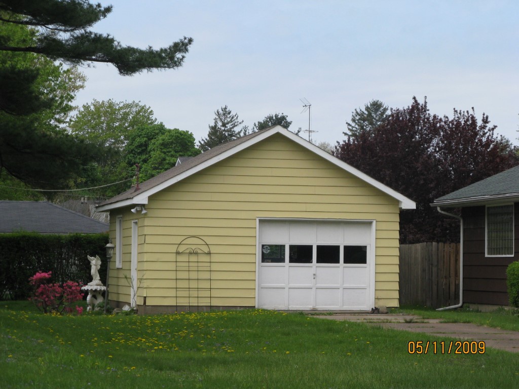
Other Buildings & Yards
Description
Built
Width
Length
Area
FRAME OR CB DETACHED GARAGE
1964
20
22
440
FRAME OR CB DETACHED GARAGE
1964
18
20
360
Sales History
Sale Date
Type
Price
Book / Page
Other Info
2/11/2019
LAND & BUILDING
0
2019 / 002357
CORRECTIVE DEED
8/17/2018
LAND & BUILDING
75000
2018 / 016856
DEED
7/19/1995
0
0393 / 1519
Parcel Sketches
Residential Card 1
A
MAIN
1200 square feet
B
OFP OPEN FRAME PORCH
196 square feet
C
EFP ENCL FRAME PORCH
130 square feet
Parcel Images
Please note:
this tab is for informational purposes only and may not show all delinquencies, see the Taxes tab for more accurate delinquent taxes due.