Elected Officials
Courts
Departments
Initiatives
Open Government
About
Login / Register
Home
/
Property & Tax Records
/
Property Records
/
Property & Tax Search
/
Parcel Profile
/
Print View
Search for Another Parcel
Parcel Profile
Historical Card
Sketches
Photos
Tax Map
Taxes
Print View
Print This Page
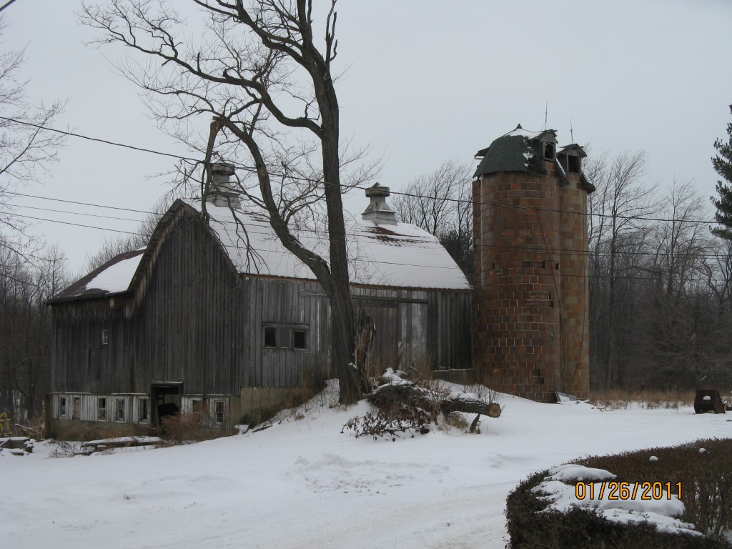
Address: PORTER RD
Parcel: 21005001004500
Parcel Profile
Address
0 | PORTER | RD
Street Status
PAVED
School District
FAIRVIEW SCHOOL
Acreage
1.5610
Classification
R
Land Use Code
OUTBUILDINGS ONLY; NO LIVING UNITS
Legal Description
PORTER RD LOT A | 1.561 AC NET
Topo
LEVEL
Utility
NONE
Zoning
Please contact your municipal zoning officer
Deed Book
2012
Deed Page
025109
2026 Tax Values
Land Value / Taxable
25,400 / 25,400.00
Building Value / Taxable
9,200 / 9,200.00
Total Value / Taxable
34,600 / 34,600.00
Clean & Green
Inactive
Homestead Status
Inactive
Farmstead Status
Inactive
Lerta Amount
0
Lerta Expiration Year
0
Other Buildings & Yards
No OBY Data Found
Sales History
Sale Date
Type
Price
Book / Page
Other Info
9/12/2012
LAND & BUILDING
25000
2012 / 025109
SPECIAL WARRANTY DEED
3/12/2009
LAND
0
1548 / 1274
DEED
9/26/2006
LAND
35000
1365 / 0437
SPECIAL WARRANTY DEED
1/24/1991
LAND & BUILDING
0
0149 / 0158
AFFIDAVIT
2/29/1980
0
1380 / 0076
5/30/1979
0
1350 / 0270
10/6/1949
0
0549 / 0071
Parcel Sketches
Invalid Parcel Number or No Sketches on File
Parcel Images
Please note:
this tab is for informational purposes only and may not show all delinquencies, see the Taxes tab for more accurate delinquent taxes due.