Elected Officials
Courts
Departments
Initiatives
Open Government
About
Login / Register
Home
/
Property & Tax Records
/
Property Records
/
Property & Tax Search
/
Parcel Profile
/
Print View
Search for Another Parcel
Parcel Profile
Historical Card
Sketches
Photos
Tax Map
Taxes
Print View
Print This Page
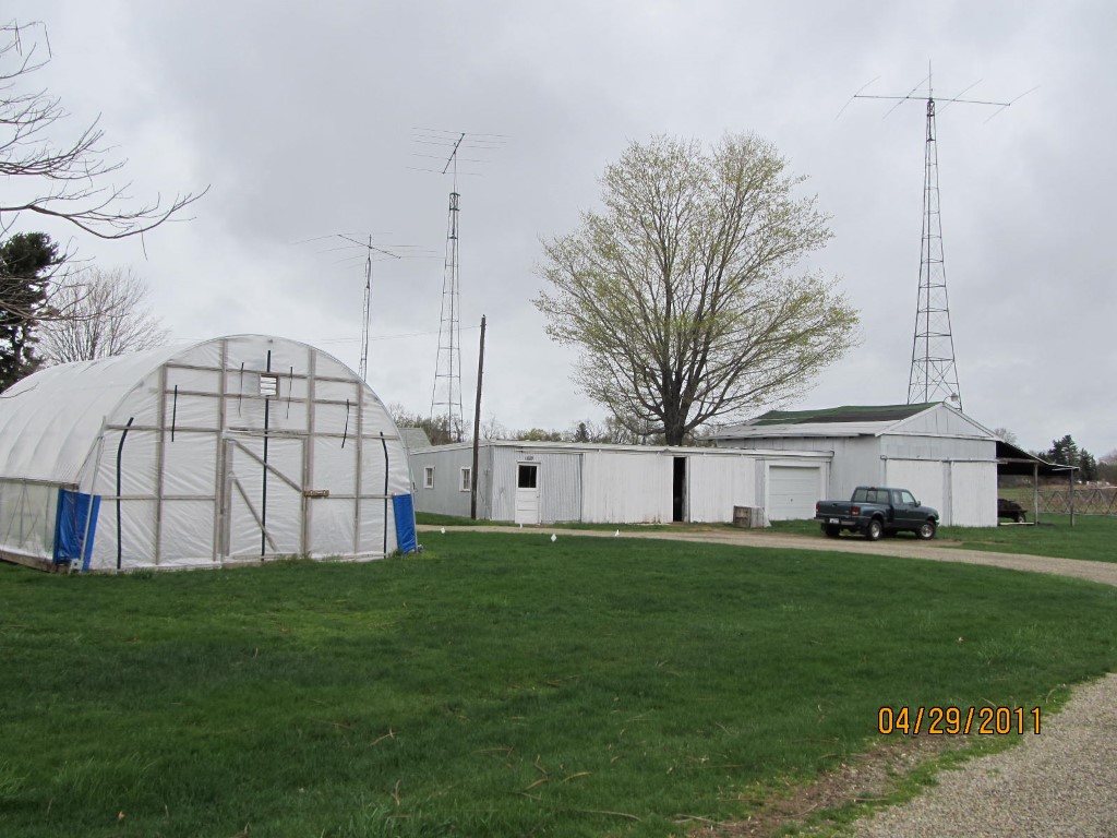
Address: AVONIA RD
Parcel: 21046061000900
Parcel Profile
Address
0 | AVONIA | RD
Street Status
PAVED
School District
FAIRVIEW SCHOOL
Acreage
17.3500
Classification
F
Land Use Code
OUT BUILDINGS ONLY: NOT LIVING UNITS
Legal Description
AVONIA RD TR 290 | 17.35 AC
Topo
LEVEL
Utility
ALL PUBLIC
Zoning
Please contact your municipal zoning officer
Deed Book
0147
Deed Page
0322
2026 Tax Values
Land Value / Taxable
84,000 / 9,700.00
Building Value / Taxable
3,700 / 3,700.00
Total Value / Taxable
87,700 / 13,400.00
Clean & Green
Active
Homestead Status
Inactive
Farmstead Status
Inactive
Lerta Amount
0
Lerta Expiration Year
0
Other Buildings & Yards
Description
Built
Width
Length
Area
FLAT BARN
1900
24
50
1200
FLAT BARN ADDITION
1900
24
32
768
1S LEAN TO
1900
18
32
576
Sales History
Sale Date
Type
Price
Book / Page
Other Info
12/27/1990
0
0147 / 0322
7/15/1985
0
1588 / 0010
2/26/1975
0
1139 / 0009
11/1/1974
0
1131 / 0508
4/4/1972
28000
1065 / 0107
11/27/1964
0
0907 / 0412
Parcel Sketches
Invalid Parcel Number or No Sketches on File
Parcel Images
Please note:
this tab is for informational purposes only and may not show all delinquencies, see the Taxes tab for more accurate delinquent taxes due.