Elected Officials
Courts
Departments
Initiatives
Open Government
About
Login / Register
Home
/
Property & Tax Records
/
Property Records
/
Property & Tax Search
/
Parcel Profile
/
Print View
Search for Another Parcel
Parcel Profile
Historical Card
Sketches
Photos
Tax Map
Taxes
Print View
Print This Page
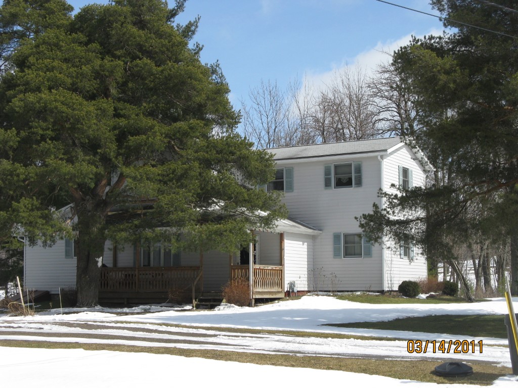
Address: 3720 KANE HILL RD
Parcel: 25002009000600
Parcel Profile
Address
3720 | KANE HILL | RD
Street Status
PAVED
School District
WATTSBURG SCHOOL
Acreage
2.1600
Classification
R
Land Use Code
SINGLE FAMILY
Legal Description
3720 KANE HILL RD 2.16 AC
Square Feet
1816
Topo
LEVEL
Utility
WELL | SEPTIC
Zoning
Please contact your municipal zoning officer
Deed Book
1004
Deed Page
2365
2026 Tax Values
Land Value / Taxable
40,200 / 40,200.00
Building Value / Taxable
96,440 / 96,440.00
Total Value / Taxable
136,640 / 136,640.00
Clean & Green
Inactive
Homestead Status
Active
Farmstead Status
Inactive
Lerta Amount
0
Lerta Expiration Year
0
Residential Data
Card 1
Style
CONVENTIONAL
Basement
PART
Year Built
1895
Exterior Wall
ALUMINUM/VINYL
Total Living Area
1816
Full Baths
1
Half Baths
1
Fuel Type
GAS
Heating
CENTRAL
Heating System
FORCED AIR
Stories
2.0
Total Bedrooms
3
Total Family Rooms
1
Total Rooms
9
Fireplaces
0
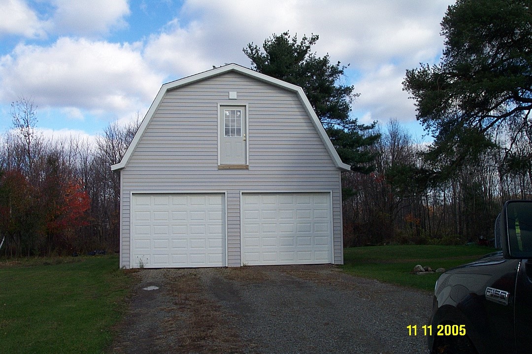
Other Buildings & Yards
Description
Built
Width
Length
Area
FRAME UTILITY SHED
1995
8
8
64
FOUR SIDE CLOSED WD POLE BLDG
2005
24
30
720
Sales History
Sale Date
Type
Price
Book / Page
Other Info
4/30/2003
LAND & BUILDING
0
1004 / 2365
QUIT CLAIM DEED
12/18/1991
0
0188 / 2002
Parcel Sketches
Residential Card 1
A
MAIN
728 square feet
B
EFP ENCL FRAME PORCH
80 square feet
C
WDDCK WOOD DECKS
208 square feet
D
1S FR ONE STORY FRAME
360 square feet
E
MA STOOP/TERR MAS STOOP
24 square feet
Parcel Images
Please note:
this tab is for informational purposes only and may not show all delinquencies, see the Taxes tab for more accurate delinquent taxes due.